
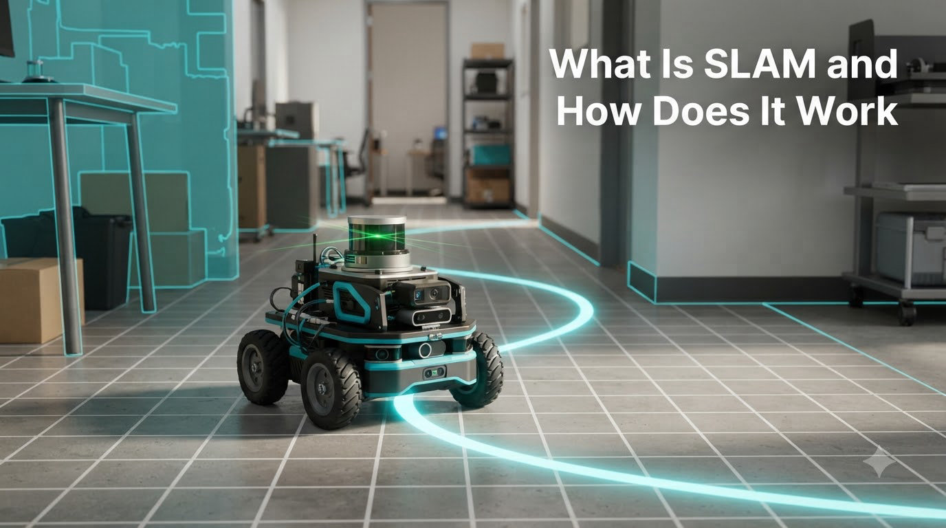
SLAM stands for Simultaneous Localization and Mapping. It is the computational process that lets a robot, drone, or autonomous vehicle build a map of an unknown environment while simultaneously tracking its own position inside that map. If you have ever watched a robot vacuum clean a room it has never seen, or wondered how a self-driving car navigates a street without prior data, you have seen SLAM in action.
Our team has spent the last several years building and testing robots that rely on SLAM, from small wheeled platforms in our lab to UAVs flying through warehouse aisles. In this guide I will walk you through the same knowledge we share with our robotics students, the core algorithms, the sensors involved, and what is changing in 2026.
Table of Contents
What Is SLAM in Robotics and Autonomous Systems
SLAM is short for Simultaneous Localization and Mapping. It solves a chicken-and-egg problem in mobile robotics. To know where you are, you need a map. To build a map, you need to know where you are. SLAM breaks that loop by estimating both at the same time using incoming sensor data.
Concretely, a SLAM system runs two coupled tasks in parallel. The localization half answers the question: where is the robot right now, with what confidence, and at what heading? The mapping half answers: what does the world around the robot look like, where are the walls, the furniture, the doors, and how do those features relate to each other? The two outputs feed each other on every update cycle.
This is what makes SLAM foundational. Without it, an autonomous system either needs a pre-built map (and stays stuck in known places) or it has no idea where it is. SLAM is what lets a delivery robot enter a building for the first time and still find its way to the lobby.
A brief history of SLAM
The SLAM problem was formally named at a 1995 robotics workshop, but its roots go back to the 1980s. Researchers like R.C. Smith and P. Cheeseman laid the statistical groundwork for estimating robot pose and landmark positions together. Hugh Durrant-Whyte and John Leonard published landmark papers in the early 1990s that defined the field.
By the 2000s, SLAM had moved from academic theory to real products. The introduction of efficient graph optimization libraries, cheap LiDAR sensors, and open-source frameworks like GMapping, Cartographer, and ORB-SLAM turned SLAM into a standard tool in any robotics engineer’s kit. In 2026, SLAM sits at the heart of nearly every autonomous system you can buy.
How Does SLAM Work Step by Step
Every SLAM system, no matter the algorithm or sensor, runs through the same five-step pipeline. I will walk you through each step using a simple wheeled robot exploring an empty room as our example.
Step 1: Read sensor data. The robot’s sensors take a snapshot of the world. A 2D LiDAR might return 360 distance measurements in a flat slice. A camera returns an image. An IMU returns acceleration and rotation rate. The SLAM pipeline always starts with raw sensor data.
Step 2: Extract features. The system pulls out distinguishable landmarks from that raw data. For a LiDAR, these are line segments, corners, or clusters of points. For a camera, they are keypoints with descriptors (think ORB or SIFT features) that the system can match between frames.
Step 3: Estimate the robot’s pose. The system compares the new sensor reading with what it expected to see based on its current map and last known pose. From the difference, it calculates how the robot has moved. This is called scan matching for LiDAR or visual odometry for cameras.
Step 4: Update the map. Once the new pose is known, the system adds the freshly observed features to the map, attaching each to a 3D position. The map grows with every step the robot takes.
Step 5: Detect and close loops. When the robot recognizes a place it has already mapped (the same corner, the same doorway), it triggers loop closure. This is a critical correction step. Without it, small pose errors accumulate into drift, and the map slowly tears itself apart. With loop closure, the system back-calculates and aligns every pose between the two visits, fixing drift in one shot.
These five steps run continuously, often at 20 to 100 Hz on a modern CPU, and every step relies on the output of the others. That tight coupling is what makes SLAM hard, and what makes it powerful.
Key SLAM Algorithms Explained
Over the past three decades, the robotics community has produced several families of SLAM algorithms. Each makes different trade-offs between accuracy, computational cost, and ease of implementation. The three most important families today are EKF SLAM, Particle Filter SLAM, and Graph-based SLAM.
Extended Kalman Filter (EKF) SLAM
The original SLAM formulation used an Extended Kalman Filter. EKF SLAM represents the robot’s pose and every landmark position in a single giant state vector, and updates them with each new observation. It is elegant and statistically rigorous, but it scales poorly. Adding more landmarks makes the covariance matrix grow quadratically, and the math becomes intractable for anything beyond a small room.
For learning, EKF SLAM is great because it shows the underlying probability theory. For production use, it has largely been replaced.
Particle Filter SLAM (FastSLAM)
FastSLAM, developed by Sebastian Thrun and colleagues in the early 2000s, uses a particle filter to estimate the robot’s path. Each particle represents a possible trajectory, and the filter keeps the ones consistent with sensor data. Landmarks are then estimated independently given each particle’s path.
FastSLAM scales better than EKF and is robust to non-linear motion. GMapping, one of the most widely deployed 2D SLAM packages, is a particle filter implementation. You will find it in many ROS-based robots.
Graph-based SLAM
Modern SLAM systems are dominated by graph-based approaches. The robot’s trajectory is represented as a graph: each node is a pose, each edge is a spatial constraint (from odometry, from scan matching, or from loop closure). The system optimizes the entire graph to find the configuration of poses that best satisfies every constraint.
Cartographer (from Google) and ORB-SLAM (visual) are graph-based. According to a recent r/robotics discussion, most modern 3D SLAM systems now use pose graph optimization rather than EKF or particle filters, and that trend has only accelerated through 2026.
For a quick comparison, here is how the three families stack up:
Algorithm family comparison:
- EKF SLAM: Best for teaching and small maps. Struggles past a few hundred landmarks. Single Gaussian assumption limits handling of ambiguity.
- Particle Filter (FastSLAM): Great for 2D indoor maps with low-cost LiDAR. Used by GMapping. Handles multi-modal hypotheses well.
- Graph-based SLAM: Current production standard. Scales to large maps and 3D. Requires a good loop closure detector and a non-linear optimizer (g2o, GTSAM, Ceres).
What Sensors Does SLAM Use
SLAM is sensor-agnostic in principle, but the choice of sensor changes the entire implementation. The four most common sensor families in modern systems are LiDAR, cameras, IMUs, and wheel encoders.
LiDAR
LiDAR (Light Detection and Ranging) measures distances by timing laser pulses. A 2D LiDAR spins a single laser to produce a flat scan, ideal for indoor robots. A 3D LiDAR stacks multiple lasers or uses a MEMS mirror to produce a dense point cloud. LiDAR gives very accurate range data and works in the dark, which is why you see it on most autonomous cars and high-end robot vacuums.
Cameras
Visual SLAM (vSLAM) uses one or more cameras. Monocular SLAM uses a single camera and must infer depth from motion, which makes scale ambiguous until you give it a known reference. Stereo SLAM uses two cameras and recovers depth directly from disparity. RGB-D SLAM (Kinect, RealSense, Azure Kinect) adds a depth sensor to a regular camera for direct 3D measurements.
ORB-SLAM3 is the de facto open-source monocular and stereo visual SLAM framework, and it is still what most students and researchers reach for first.
IMU and wheel odometry
An IMU (Inertial Measurement Unit) reports acceleration and angular velocity at high rates. Wheel encoders report how far each wheel has turned. Neither can build a map on its own, but both help predict the robot’s motion between sensor frames. Most production SLAM stacks fuse LiDAR or camera data with an IMU using an extended Kalman filter or a factor graph. This is called visual-inertial odometry (VIO) or LiDAR-inertial odometry (LIO), and it is the gold standard for drones and AR/VR headsets.
Are SLAM and LiDAR the same?
No, and this is one of the most common points of confusion. SLAM is a software problem, the algorithm that builds a map and tracks the robot. LiDAR is a hardware sensor, a device that measures distance. You can do SLAM with LiDAR, but you can also do SLAM with cameras, sonar, radar, or even the bump sensors on a basic robot. Many modern systems use cameras and IMU together, with no LiDAR at all. Apple, for example, uses camera-based visual-inertial SLAM on every iPhone for AR. If you want to experiment with SLAM on a budget, our beginner’s guide to Arduino covers some hardware options that pair well with simple visual SLAM setups.
Types of SLAM Methods Compared
Once you understand the algorithms and sensors, the next layer of distinction is the type of SLAM. Different applications need very different implementations.
2D vs 3D SLAM. 2D SLAM produces a flat floor-plan style map. It is fast, cheap, and perfect for indoor wheeled robots that operate on a single level. 3D SLAM produces a full volumetric map, required for drones, autonomous cars, and any robot that needs to reason about multi-level or outdoor spaces.
Visual vs LiDAR SLAM. Visual SLAM is cheaper and gives richer information (color, texture, semantic labels) but struggles in low light and featureless environments. LiDAR SLAM is more accurate, works in any lighting, and is robust to textureless walls, but it costs more and produces sparser data. Most modern autonomous vehicles and warehouse robots use LiDAR-inertial SLAM as their primary system, often with cameras as a secondary perception layer.
Online vs offline SLAM. Online (or real-time) SLAM runs on the robot as it moves and updates the map continuously. Offline SLAM processes the entire sensor log after the robot finishes its mission. Surveyors often use offline SLAM because it can use every observation to refine every pose, producing highly accurate maps that would be too slow to compute in real time.
Indoor vs outdoor SLAM. Indoor SLAM deals with structured environments, walls, hallways, and rooms, where loop closure is frequent. Outdoor SLAM deals with unstructured terrain, GPS dropouts, and far fewer loop closure opportunities, which is why outdoor systems lean heavily on IMU fusion and global positioning aids.
Real-World SLAM Applications
SLAM is no longer a research curiosity. It runs in millions of devices today, and our team has directly worked with several of them.
Robot vacuums. Modern robot vacuums (Roomba, Roborock, Dreame) use 2D LiDAR SLAM to build a map of your home. The first time the vacuum runs, it explores room by room. The second time, it follows the saved map. This is SLAM in its purest, most consumer-facing form.
Autonomous vehicles. Self-driving cars from Waymo, Cruise, and others use 3D LiDAR SLAM fused with cameras, radar, and GPS to maintain a centimeter-accurate map of the road while tracking their position. HD maps used by these cars are often built using offline SLAM on recorded drives.
Drones. UAVs use visual-inertial SLAM for indoor flight, GPS-denied navigation, and search-and-rescue missions. Our Wi-Fi control guide covers how some of these drones are commanded, but SLAM is what keeps them stable and aware indoors.
Warehouse and delivery robots. Amazon’s Kiva robots, Symbotic’s systems, and many last-mile delivery robots use 2D and 3D SLAM to navigate warehouses and sidewalks. The robot must know exactly where each shelf is and update its map as humans move things around.
AR/VR and mobile devices. ARKit (iOS) and ARCore (Android) use visual-inertial SLAM to track your phone in 3D space so that virtual objects stay anchored to real surfaces. Every Pokémon you have ever seen placed on your kitchen table was positioned by a SLAM algorithm running on your phone.
Surveying and mapping. Handheld or backpack-mounted LiDAR SLAM systems (Leica BLK, GeoSLAM, Hesai) are now standard for indoor surveying, construction documentation, and mine mapping. They produce georeferenced 3D point clouds in minutes.
Challenges and the Future of SLAM
SLAM is a mature field, but it is not solved. The open problems our team still runs into on real robots are the most interesting ones.
Dynamic environments. Classical SLAM assumes the world is static. People walking through a museum or trucks moving in a warehouse break that assumption. Modern research uses semantic segmentation to identify and ignore dynamic objects, or treats them as part of the map.
Long-term autonomy. A SLAM map built today may be wrong tomorrow. Furniture moves, doors open, seasons change. Lifelong SLAM is an active research area focused on updating maps over weeks and months without human intervention.
Computational cost. High-accuracy 3D SLAM can demand significant compute. Modern solutions offload work to the cloud, where SLAM as a Service (such as Google Cartographer Cloud and several startups) runs graph optimization on powerful servers. The robot streams sensor data, the cloud returns a pose. Our robotics forum has a recurring thread where engineers debate cloud SLAM versus edge SLAM trade-offs, and the answer is always: it depends on your latency, privacy, and bandwidth constraints.
Multi-robot SLAM. Letting a fleet of robots share maps in real time is harder than it sounds. Each robot’s local map has its own drift, and merging them requires robust place recognition and distributed optimization. Companies like Skydio and Boston Dynamics have made huge progress here in 2026.
AI-augmented SLAM. The biggest shift in 2026 is the fusion of deep learning with classical SLAM. Neural networks now provide feature extractors, depth estimators, and end-to-end pose regressors that outperform traditional pipelines in many scenarios. At the same time, classical SLAM still wins on data efficiency and interpretability. The next generation of production systems will likely be hybrid, with learned front-ends feeding into a graph-based back-end.
Frequently Asked Questions
Are SLAM and LiDAR the same?
No. SLAM is the software algorithm that builds a map and tracks the robot’s position at the same time. LiDAR is a hardware sensor that measures distance with laser pulses. You can run SLAM with LiDAR, with cameras, with sonar, or with a combination of sensors. LiDAR is one input to SLAM, not a synonym for it.
How does SLAM work in simple terms?
SLAM works by combining sensor readings with movement estimates on every update cycle. The system reads data from its sensors, extracts features like walls or corners, compares those features to what it has seen before to estimate how the robot has moved, updates the map with the new observations, and checks for loop closure to correct accumulated drift. It runs continuously, often 20 to 100 times per second.
Can you do SLAM without LiDAR?
Yes. Visual SLAM uses cameras instead of LiDAR and is widely used on smartphones, AR headsets, and budget drones. Monocular SLAM uses a single camera, stereo SLAM uses two, and RGB-D SLAM adds a depth sensor. Many of these systems match or exceed LiDAR SLAM in well-lit, textured environments, and they cost much less.
What are the different types of SLAM methods?
The main SLAM types are 2D SLAM (flat floor-plan maps for indoor robots), 3D SLAM (volumetric maps for drones and cars), Visual SLAM (camera-based, including monocular, stereo, and RGB-D), LiDAR SLAM (laser-based), and Visual-Inertial SLAM (camera plus IMU fusion). There are also online versus offline variants, and EKF, particle filter, and graph-based algorithm families.
What is a particle filter in SLAM?
A particle filter is an algorithm that represents the robot’s possible position as a cloud of weighted samples, called particles. Each particle is a hypothesis about where the robot is and what the map looks like. As new sensor data arrives, unlikely particles are discarded and likely ones are duplicated. FastSLAM and the GMapping package are the best-known particle filter SLAM implementations.
Is the Kalman Filter still used in SLAM?
Yes, but rarely as the full SLAM backend anymore. EKF SLAM is still taught in robotics courses and works well for very small maps. In production systems, the Extended Kalman Filter is more often used to fuse IMU data with LiDAR or camera measurements, while the full map and trajectory are optimized with a graph-based backend.
Where to Go From Here
SLAM is the backbone of every robot that has to make sense of where it is. We have covered the definition of SLAM, the step-by-step process of how it works, the main algorithm families, the sensors that power it, the different types, and where it shows up in real products. If you want to see SLAM in hardware, our guide on how a robot chassis works explains the physical platforms you would mount a LiDAR or camera on. If you are building your first SLAM project, start with ROS 2, GMapping, and a low-cost 2D LiDAR, and you will have a working map within a weekend. For more on what SLAM is and how it keeps evolving in 2026, subscribe to our robotics newsletter.