
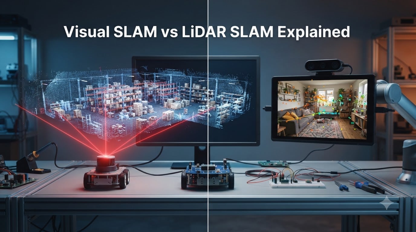
If you have ever watched a robot vacuum glide confidently under furniture or seen a drone hold position in midair, you have watched SLAM at work. Visual SLAM vs LiDAR SLAM is one of the most important technology comparisons in modern robotics, because both approaches solve the same problem: how does a machine map an unknown space while simultaneously tracking where it is inside that map?
In this guide I break down how each technology works, where it excels, and where it falls short. I have spent weeks reviewing research papers, community discussions on r/robotics, and product teardowns to put together the clearest comparison available in 2026. By the end you will know exactly which SLAM approach fits your robot, drone, or autonomous vehicle project.
You will also get answers to the most common follow-up questions, including why Tesla famously avoids LiDAR and what the three main types of LiDAR sensors actually do.
Table of Contents
What Is SLAM and Why Does It Matter
SLAM stands for Simultaneous Localization and Mapping. It is the computational problem of building a map of an unknown environment while a robot or device keeps track of its own position within that map at the same time. The two tasks are deeply linked: an accurate map makes localization easier, and an accurate pose estimate makes mapping easier.
SLAM matters because it is the foundation of every autonomous system that needs to navigate without GPS. Robot vacuums use SLAM to clean room by room. Drones use SLAM to fly indoors where satellite signals fail. Warehouse robots use SLAM to move pallets without crashing into shelves. Self-driving cars use a form of SLAM (often called localization) to position themselves within a known high-definition map.
There are two dominant sensor families used to feed SLAM algorithms: cameras, which power Visual SLAM (vSLAM), and laser rangefinders, which power LiDAR SLAM. Both produce data that a SLAM algorithm can turn into a usable map and a real-time pose estimate, but they do it in very different ways.
Before we compare them, it helps to know that most modern SLAM systems also fuse data from an IMU (inertial measurement unit). Visual-Inertial Odometry (VIO) and LiDAR-IMU fusion dramatically improve robustness, which is why a pure camera or pure LiDAR comparison is really a comparison of the dominant sensor, not the only one.
The Core SLAM Pipeline
Every SLAM system, regardless of sensor, follows the same general pipeline. The sensor collects raw measurements of the environment. A front-end extracts features or geometric landmarks. A back-end estimates the robot pose and landmark positions using algorithms like Extended Kalman Filters, particle filters, or graph optimization. A loop closure module recognizes when the robot has returned to a previously visited area and corrects accumulated drift.
Where Visual SLAM and LiDAR SLAM diverge is almost entirely in the front-end. Cameras see photons. LiDAR sees distance. Everything that flows downstream is shaped by that single difference.
How LiDAR SLAM Works
LiDAR SLAM uses laser pulses to measure precise distances to surrounding objects. A LiDAR sensor fires rapid laser pulses (often hundreds of thousands per second), measures how long each pulse takes to bounce back, and converts that time-of-flight into a distance reading. As the sensor rotates or scans, it produces a dense point cloud, which is essentially a 3D snapshot of everything in its field of view.
The SLAM algorithm takes successive point clouds and aligns them using a technique called ICP (Iterative Closest Point) or similar scan-matching methods. From the alignment, the system calculates how the sensor has moved between scans. Over time, the algorithm stitches these relative movements into a global map and a trajectory of the robot.
LiDAR SLAM is famous for one thing: precision. Modern 3D LiDAR units can measure distances within a few centimeters at ranges over 100 meters, regardless of lighting conditions. That is why you see them on Waymo robotaxis, autonomous trucks, and high-end mapping drones.
What Are the Three Types of LiDAR?
There are three main types of LiDAR sensors used in SLAM applications today.
1D LiDAR is the simplest form. It scans a single line, usually in one plane, and is common in low-cost robot vacuums and basic obstacle detection. It cannot distinguish between objects at different heights, but it is cheap and reliable.
2D LiDAR spins a single laser beam 360 degrees in a flat plane, creating a circular scan of the environment at one height. This is the workhorse of older SLAM systems, indoor service robots, and research platforms. It produces a planar slice of the world rather than a full 3D model.
3D LiDAR uses multiple laser beams (often 16, 32, 64, or 128 channels) to build a full 3D point cloud with every rotation. This is what you see on autonomous vehicles and high-end mapping systems. It captures vertical detail, which makes it excellent for complex outdoor environments and detailed indoor modeling.
Where LiDAR SLAM Excels
LiDAR SLAM is at its best outdoors, in large open spaces, and wherever lighting is unreliable. Because it measures distance directly, it does not need ambient light to function, and it can operate equally well in bright sunlight, complete darkness, or fog (within sensor range limits). It produces geometrically accurate maps that are easy to inspect and validate, which matters for safety-critical applications.
How Visual SLAM Works
Visual SLAM uses cameras to capture images of the environment and infer motion from how those images change over time. A monocular camera uses a single lens, while stereo and RGB-D cameras add depth information. The algorithm extracts distinctive features (corners, edges, textures) from each frame, then tracks those features across consecutive frames to estimate camera motion. This technique is called visual odometry.
The same feature-tracking pipeline also builds a sparse or semi-dense map of the environment. Feature points become landmarks, and the algorithm continually refines their 3D positions and the camera trajectory through a process called bundle adjustment. Loop closure in Visual SLAM typically relies on appearance-based place recognition, such as bag-of-words models or deep learning embeddings, to detect when the camera has returned to a previously mapped area.
Modern Visual SLAM systems, including ORB-SLAM3, OpenVSLAM, and RTAB-Map, can run on commodity hardware and even on high-end smartphones. The cameras themselves cost a tiny fraction of a 3D LiDAR unit, which is the main reason Visual SLAM has exploded in consumer robotics, AR, and drone applications.
Where Visual SLAM Excels
Visual SLAM shines in texture-rich indoor environments, lightweight platforms, and applications where the camera serves double duty (for SLAM, obstacle detection, and computer vision). Drones love it because the camera weighs almost nothing compared with a LiDAR unit. AR headsets use it because the camera can also display what the user sees. Robot vacuums in the mid-range price bracket increasingly rely on it because it is far cheaper than a 360-degree LiDAR.
Visual SLAM also works at altitudes where LiDAR can struggle. The r/robotics community has repeatedly reported that LiDAR SLAM typically fails at high altitudes, while Visual Inertial Odometry (VIO) works on both ground and air platforms. That single observation has shaped the drone industry, where VIO is now standard for indoor flight and GPS-denied navigation.
Where Visual SLAM Struggles
Visual SLAM breaks down in low-texture environments (blank white walls, featureless hallways), in low light, and when the camera is exposed to direct glare or sudden lighting changes. It also tends to accumulate more drift than LiDAR over long trajectories, which is why it is often paired with a good IMU and periodic loop closure corrections.
Visual SLAM vs LiDAR SLAM: Side-by-Side Comparison
The table below summarizes the most important differences between the two approaches. I have weighted these based on what actually matters for real-world robot deployments, not just textbook performance.
| Attribute | LiDAR SLAM | Visual SLAM |
|---|---|---|
| Sensor cost (entry-level) | $50 to $300 for 2D; $1,000+ for 3D | $5 to $50 for a quality camera module |
| Range accuracy | Centimeter-level at 100 m+ | Decimeter-level at typical indoor ranges |
| Performance in low light | Excellent (active sensor) | Poor to fair (depends on IR or exposure) |
| Performance in bright sun | Excellent | Fair to good (glare and saturation) |
| Weight and payload | Heavier, especially 3D units | Very light (a few grams) |
| Indoor performance | Excellent | Excellent in textured spaces, weak in blank ones |
| Outdoor performance | Excellent | Fair, weather and lighting sensitive |
| High-altitude performance | Often fails | Works on ground and air |
| Processing requirements | Moderate CPU, moderate GPU | Higher CPU/GPU for feature extraction |
| Map output | Geometric point cloud | Sparse feature map or semi-dense |
| Best use case | Autonomous cars, mapping, outdoor robots | Drones, AR, low-cost vacuums, lightweight robots |
The biggest takeaway from this table is that neither technology is universally better. The right choice depends on the environment, the platform’s weight budget, the lighting, and how much you can spend on the sensor stack. A drone that needs to fly at 30 meters indoors will pick Visual SLAM almost every time. A mapping van that needs to survey a city will pick 3D LiDAR every time.
For a deeper look at the underlying hardware that runs these algorithms, our guide to single board computers explains which platforms can actually handle Visual SLAM in real time.
Indoor vs Outdoor Use Cases
Environment is the single biggest decision factor in the Visual SLAM vs LiDAR SLAM debate. Each technology has a sweet spot.
Indoor environments favor Visual SLAM when there is enough texture (furniture, posters, varied wall patterns) and lighting. They favor LiDAR when the space is large, open, and geometrically complex, such as warehouses and factories. Robot vacuums in the $400 to $800 range often ship with a 2D LiDAR because it produces consistent mapping in low-texture rooms. Premium vacuums now pair LiDAR with a downward camera to fuse both data sources.
Outdoor environments generally favor LiDAR. Sunlight washes out cameras, dust and precipitation scatter laser pulses less aggressively, and the geometric accuracy of a 3D point cloud makes post-processing easier. That is why nearly every commercial autonomous vehicle, from Waymo’s robotaxis to most autonomous trucking pilots, relies on LiDAR as the primary perception sensor.
Altitude flips the script. LiDAR sensors have a minimum effective range, often around 0.5 to 1 meter, because their laser pulses cannot return accurately from too close. A drone flying at 30 meters will see the ground far below the LiDAR’s effective return, and the featureless sky gives the camera plenty of texture to work with. This is why VIO is the dominant SLAM approach for drones.
Lighting edge cases also matter. Tunnels, parking garages, and night driving punish Visual SLAM. Bright midday glare on snow or water punishes it too. LiDAR handles all of these without breaking a sweat.
Cost, Processing Power, and Implementation Complexity
Cost is where Visual SLAM wins almost every comparison. A quality global-shutter camera module costs less than a meal out. A basic 2D LiDAR costs roughly the same as a mid-range smartphone. A 64-channel 3D LiDAR for autonomous driving costs more than a used car.
For hobbyists and small product teams, that cost gap is the entire conversation. A 2D LiDAR plus a basic microcontroller can produce a working SLAM map for under $200 in hardware. Doing the same with a 3D LiDAR is rarely worth it unless you need outdoor accuracy. Visual SLAM, by contrast, can run on a $50 camera plus a board like the ESP32 for robotics projects (for simple visual odometry) or on a Jetson Nano for full Visual SLAM.
Processing power is a more nuanced story. LiDAR scan matching looks computationally heavy, but the data is structured and the algorithms are mature. A modern ARM Cortex-A series CPU can handle 2D LiDAR SLAM in real time. Visual SLAM, on the other hand, relies on feature extraction and image processing, which benefit heavily from GPU acceleration or dedicated NPUs. Running Visual SLAM on a plain microcontroller is impractical, but running it on a smartphone-class SoC is easy.
Implementation complexity has improved dramatically on both sides. Open-source packages like Cartographer, GMapping, and Hector SLAM cover most LiDAR use cases. For Visual SLAM, ORB-SLAM3, RTAB-Map, and OpenVSLAM provide production-ready pipelines. Neither approach is trivial for a complete beginner, but both have active communities and lots of ROS integration.
Real-World Applications in 2026
The most visible consumer application of LiDAR SLAM today is the robot vacuum. Brands like Roborock, Dreame, and ECOVACS rely on 2D LiDAR plus bump sensors to clean room by room with surgical precision. Visual SLAM has gained ground in mid-range vacuums, but LiDAR still produces the most consistent maps according to teardowns on r/robotics.
Drones are the opposite story. DJI’s consumer drones use Visual SLAM (often VIO with stereo cameras and an IMU) for indoor positioning and obstacle avoidance, because the camera adds almost no weight. A LiDAR unit of equivalent quality would either be too heavy or too expensive for a $1,000 drone.
Autonomous vehicles are still LiDAR-dominated in 2026, with Waymo, Cruise, and most trucking startups running 3D LiDAR as the primary sensor. Tesla’s camera-only stance remains controversial and is the most-discussed exception in the field.
AR and VR headsets, including the Meta Quest 3 and Apple Vision Pro, use Visual SLAM to track the wearer’s position inside a room. The cameras serve both SLAM and pass-through video, which is a major reason cameras win in this category.
Warehouse robots from companies like Locus Robotics and Symbotic blend both worlds. They use 2D LiDAR for safety and obstacle detection, plus depth cameras for picking and identification. This kind of sensor fusion is becoming the default for serious commercial deployments.
Future Trends: SLAM in 2026 and Beyond
The next few years will not be about Visual SLAM or LiDAR SLAM winning the debate. The real story is sensor fusion. Most serious robot platforms already combine cameras, LiDAR, IMU, and sometimes radar or ultrasound into a unified SLAM stack. The Open Robotics community has been pushing this direction for years, and 2026 is the year it becomes standard practice for any non-trivial deployment.
AI is also reshaping both sides. Modern Visual SLAM increasingly uses learned features and neural radiance fields (NeRFs) to build dense, photorealistic maps. LiDAR SLAM is gaining deep-learning-based loop closure and semantic segmentation. Both are being accelerated at the edge through specialized silicon, which is why edge AI in robotics has become inseparable from the SLAM conversation.
Cost is moving fast too. Solid-state LiDAR units that cost thousands in 2026 are dropping below $500 for consumer-grade 3D sensors, and high-resolution global-shutter cameras are now cheaper than ever. The lines between mid-range Visual SLAM and entry-level LiDAR SLAM are blurring in the most interesting way.
Frequently Asked Questions
Why does Elon Musk not use LiDAR?
Elon Musk argues that cameras are sufficient for autonomous driving because humans navigate the world using only two eyes. He has called LiDAR a crutch and pointed out that adding a second sensor increases cost, weight, and failure modes. Tesla’s Full Self-Driving stack relies on eight cameras plus radar and an AI-only perception pipeline, betting that neural networks can match the precision of LiDAR at a fraction of the hardware cost. Critics counter that LiDAR provides geometric accuracy cameras cannot match in poor lighting, and that no production robotaxi operates today without LiDAR.
What does LiDAR SLAM mean?
LiDAR SLAM is a SLAM implementation that uses a laser rangefinder as the primary sensor. The LiDAR fires laser pulses, measures the reflected return time, and builds a 3D point cloud of the environment. The SLAM algorithm aligns successive point clouds to estimate the sensor’s motion, then stitches those motion estimates into a global map and a real-time trajectory.
What are the three types of LiDAR?
The three main types of LiDAR are 1D, 2D, and 3D. 1D LiDAR measures distance along a single line and is used for simple presence detection. 2D LiDAR spins one laser beam 360 degrees in a plane to create a circular scan, which is the workhorse of indoor service robots. 3D LiDAR uses multiple laser channels to build a full 3D point cloud with every rotation, and is standard on autonomous vehicles and high-end mapping systems.
What does visual SLAM mean?
Visual SLAM (vSLAM) is a SLAM implementation that uses cameras as the primary sensor. The algorithm extracts visual features from each frame, tracks them across consecutive frames to estimate camera motion, and builds a sparse or dense map of the environment. When paired with an IMU, it is often called Visual Inertial Odometry (VIO).
Which is more accurate, LiDAR or visual SLAM?
LiDAR SLAM is generally more accurate for distance and geometric measurements, especially over long ranges and in feature-poor environments. Visual SLAM can match or exceed LiDAR accuracy in short-range, texture-rich scenarios, but it tends to accumulate more drift over long trajectories. The accuracy gap is closing as Visual SLAM algorithms improve, but LiDAR still wins for safety-critical outdoor mapping.
Is LiDAR SLAM obsolete with modern visual SLAM improvements?
No. Modern Visual SLAM has closed much of the gap in indoor and lightweight applications, but LiDAR SLAM still dominates outdoor, long-range, and safety-critical deployments. The industry trend is sensor fusion rather than replacement: production robots use cameras, LiDAR, and IMUs together to combine the strengths of each.
Final Verdict: Choosing Between Visual SLAM and LiDAR SLAM
The Visual SLAM vs LiDAR SLAM choice comes down to four questions. What environment will the robot operate in? How much weight can the platform carry? What is the lighting like? And what is the budget for sensors? If you answered indoor, low weight, well lit, and low budget, choose Visual SLAM. If you answered outdoor, heavy platform, any lighting, and high budget, choose LiDAR SLAM.
For most hobbyists and small product teams in 2026, the best starting point is Visual SLAM on a camera plus IMU, because the cost and weight are nearly unbeatable. For commercial mapping, autonomous vehicles, and warehouse robots, LiDAR SLAM (often fused with cameras) remains the gold standard. The good news is that you do not have to pick a side forever: the two technologies are converging into hybrid stacks faster than most people realize.
Start with a clear understanding of your environment, pick the sensor that matches it, and add an IMU either way. That is the shortest path to a working SLAM system in 2026.