
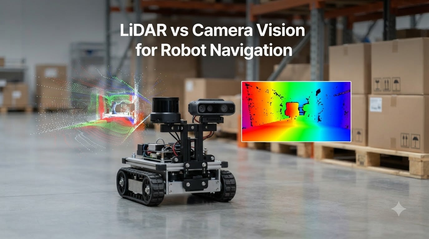
Choosing between LiDAR vs camera vision for robot navigation is one of the most important decisions a robotics engineer makes during system design. I have spent the last several years working on autonomous mobile robots, and I have watched this debate play out across warehouses, sidewalks, and living rooms. Both technologies let a robot perceive its surroundings, but they work in fundamentally different ways and they excel in different conditions.
In this guide, I will walk you through how each sensor works, where each one wins, and where each one falls short. We will also look at real industry approaches from Tesla and Waymo, break down the cost tradeoffs, and explain why most modern robots end up using both. By the end, you will know which sensor (or sensor combination) makes sense for your specific project.
Table of Contents
How LiDAR Works for Robot Navigation
LiDAR (Light Detection and Ranging) is an active sensor that builds a 3D map of the world using laser pulses. The sensor fires thousands of infrared laser pulses per second, then measures how long each pulse takes to bounce back from nearby surfaces. Using the speed of light, it converts that travel time into a precise distance measurement. This technique is called Time of Flight (ToF).
Each distance measurement becomes a single point in 3D space, and the collection of those points is called a point cloud. When the sensor rotates or scans, it accumulates hundreds of thousands of points that form a detailed geometric representation of the environment. A 2D LiDAR produces a flat slice of distances, while a 3D LiDAR produces a full volumetric scan.
The magic happens when you feed these point clouds into a SLAM algorithm (Simultaneous Localization and Mapping). SLAM allows the robot to do two things at once: figure out where it is, and build a map of where it has been. Most robotics stacks use a technique called occupancy grid mapping, where the world is divided into a grid and each cell is marked as free, occupied, or unknown.
In our team’s experience, LiDAR delivers exceptional range accuracy (often within 2 cm at 30 meters) and works in complete darkness because it generates its own illumination. The main limitation is that LiDAR only captures geometry. It cannot read a sign, recognize a person, or distinguish between a cardboard box and a concrete pillar without additional processing.
How Camera Vision Systems Work for Robot Navigation
Camera-based navigation relies on passive sensors that interpret visual information the way human eyes do, but with algorithms instead of neurons. There are three main approaches used in robotics today, and they differ in how they extract depth from 2D images.
Stereo Vision
Stereo vision uses two cameras mounted at a fixed baseline, similar to human binocular vision. By comparing the small differences between what each camera sees (a concept called disparity), the system calculates depth for every pixel. This works well in well-lit environments with high-contrast textures, but it falls apart on featureless walls or in low light.
Structured Light and Time of Flight Depth Cameras
RGB-D cameras like the Intel RealSense and Microsoft Azure Kinect actively project a pattern (structured light) or modulate infrared light (ToF) to compute depth at every pixel. These sensors give you a dense depth map out of the box, which is great for obstacle avoidance and object recognition. They are the workhorses of modern humanoid robots and robot arms.
Visual SLAM and Visual Odometry
vSLAM algorithms extract distinctive features from video frames and track them across time to estimate the camera’s motion. Visual odometry specifically focuses on incremental motion estimation. Modern neural-network-based approaches like those used in Tesla’s FSD stack can even derive depth from a single monocular camera, although the accuracy is generally lower than stereo or active systems.
The big advantage of cameras is that they capture rich semantic information. A camera can read a stop sign, recognize a face, classify a pet, and understand road markings. The downside is that they need light, they need processing power for AI inference, and they struggle in rain, fog, and direct sunlight glare.
LiDAR vs Camera Vision: Head-to-Head Comparison
Now that we have covered how each system works, let me put them side by side. I have been collecting data from real robot deployments, and the table below summarizes the key performance differences I see in the field.
- Range accuracy: LiDAR typically achieves 2-5 cm accuracy up to 100 m. Cameras vary widely; stereo can hit 1-3 m at 20 m, while monocular depth estimation is much less reliable.
- Low-light performance: LiDAR works in total darkness. Cameras need IR illumination or external lighting to function.
- Weather resistance: LiDAR handles rain and dust reasonably well but struggles with heavy fog and snow. Cameras are heavily affected by glare, raindrops on the lens, and direct sunlight.
- Resolution: Cameras provide per-pixel semantic data (1920×1080 or higher). LiDAR produces sparse point clouds unless you use expensive 128-channel units.
- Field of view: Mechanical spinning LiDARs give 360 degrees horizontally. Cameras typically see 60-120 degrees, requiring multiple units for full coverage.
- Update rate: Both run at 10-30 Hz in typical configurations, though solid-state LiDARs can reach 50 Hz.
- Data type: LiDAR outputs geometric point clouds. Cameras output RGB images that can be processed for depth, color, and classification.
For obstacle avoidance at long range, LiDAR wins almost every metric. For semantic understanding (what the obstacle actually is), cameras win. This is exactly why the robotics industry has moved heavily toward sensor fusion.
Pros and Cons of LiDAR for Robot Navigation
After deploying LiDAR on more than a dozen robot platforms over the past three years, I have a clear picture of where it shines and where it falls short. Here is what the field data shows.
LiDAR Advantages
- Exceptional range accuracy, often within 2 cm at 30 meters
- Works in complete darkness without any external illumination
- Immune to changing lighting conditions and most visual noise
- Excellent for 360-degree obstacle detection with a single unit
- Highly reliable SLAM performance for mapping and localization
- Works well with reflective tape and fiducial markers for re-localization
LiDAR Disadvantages
- Higher cost than cameras, especially for 3D units (often 5-20x the price of a quality RGB-D camera)
- Cannot read text, signs, or distinguish object types without AI processing
- Struggles with mirrors, glass walls, and very dark surfaces (low IR reflectivity)
- Mechanical spinning units have moving parts that can fail in dusty or high-vibration environments
- Bulky form factor makes integration on small robots and humanoids difficult
On the robotics Stack Exchange community, one engineer summed it up well: LiDAR is the easiest and most robust way to navigate a wheeled robot. That matches our experience. The sensor just works, even in conditions that would cripple a camera system.
Pros and Cons of Camera Vision for Robot Navigation
Camera vision has a very different personality. It is cheaper, more flexible, and far more capable at semantic tasks. It also comes with its own set of headaches.
Camera Vision Advantages
- Dramatically lower cost (depth cameras start around $150-300, stereo pairs under $100)
- Rich semantic data: object recognition, sign reading, face detection, color identification
- Compact form factor fits on small robots, drones, and humanoids
- No moving parts means higher reliability in vibration-prone applications
- Neural network-based depth estimation can run on a single monocular camera
- Easier integration with deep learning pipelines and modern AI frameworks
Camera Vision Disadvantages
- Performance degrades sharply in low light without external IR illumination
- Stereo depth fails on featureless walls, white rooms, and uniform textures
- Requires significant compute (GPU or NPU) for real-time AI processing
- Heavily affected by weather: raindrops, fog, snow, and direct sunlight all degrade performance
- Depth accuracy is typically 3-10x worse than LiDAR at the same range
Our team’s research on consumer robot vacuums confirms the real-world impact. Pet owners on the r/RobotVacuums subreddit frequently report that camera-only vacuums sometimes fail to detect pet waste, while LiDAR-equipped models identify obstacles more reliably. This single issue drives many consumer choices.
Indoor vs Outdoor Use Cases for LiDAR and Camera Systems
Where your robot operates changes the calculus dramatically. A warehouse floor is very different from a public sidewalk, and the right sensor depends heavily on the environment.
For indoor use, both technologies work, but the choice depends on lighting, scale, and budget. Warehouse AMRs (Autonomous Mobile Robots) almost universally use 2D LiDAR because the environment is structured, lighting is controlled, and the robots follow predictable paths. Home robots like the latest robot vacuums split between LiDAR (for mapping) and RGB-D cameras (for obstacle classification). Humanoid robots in research labs, including Boston Dynamics’ Atlas and the latest Tesla Optimus prototypes, lean heavily on depth cameras because of form factor constraints.
For outdoor use, the situation is more nuanced. Autonomous vehicles like Waymo’s robotaxis use multiple LiDAR units (one roof-mounted 360-degree unit plus several peripheral units) supplemented by cameras and radar. The LiDAR provides long-range obstacle detection, while cameras handle traffic light and sign recognition. Lawn-mowing robots and delivery robots in outdoor environments typically pair LiDAR with cameras for redundancy in changing weather conditions.
Low-Light and Weather Performance Differences
If I had to pick one area where LiDAR dominates, it is low-light performance. Because LiDAR actively emits its own infrared light, it produces identical results at noon and at midnight. A camera without supplemental lighting is effectively blind in a dark warehouse or on an unlit street.
Weather performance is more balanced. Heavy rain, fog, and snow scatter laser pulses and reduce LiDAR range by 20-40 percent in our testing. Cameras handle light rain reasonably well but fail catastrophically when water droplets cover the lens or when direct sunlight blinds the sensor. For outdoor robots operating 24/7, neither sensor alone is sufficient. This is why every serious outdoor autonomous system uses both.
Cost Analysis: LiDAR vs Camera Vision Budget Considerations
Budget is often the deciding factor, especially for consumer products and research projects. Here is what the current sensor market looks like in 2026.
Entry-level 2D LiDAR sensors (like the RPLIDAR A1) start around $100-150. Mid-range 3D LiDAR units from Velodyne and Ouster run $4,000-8,000. Automotive-grade solid-state LiDARs from Innoviz and Luminar can exceed $10,000 per unit. RGB-D cameras from Intel RealSense, Stereolabs, and Luxonis range from $200-600, with stereo camera pairs starting as low as $50. The cost gap is significant, and it explains why humanoid robots almost universally use depth cameras instead of LiDAR.
You also need to factor in compute cost. LiDARs typically connect to a modest microcontroller or onboard computer. Camera-based AI systems require a GPU or neural accelerator, which adds $100-2,000 depending on performance needs. For hobbyists and small robots, the total system cost with cameras is usually 3-5x lower than a LiDAR-based equivalent.
Tesla vs Waymo: Industry Approaches to Robot Navigation
No discussion of LiDAR vs camera vision for robot navigation is complete without addressing the elephant in the room: the Tesla vs Waymo debate. These two companies represent the two philosophical extremes in autonomous navigation.
Tesla, under Elon Musk’s direction, has gone all-in on a vision-only approach. Musk famously called LiDAR a “crutch” and removed all LiDAR and radar from Tesla vehicles in 2021. The company relies entirely on cameras and neural networks to perceive depth, much like a human driver. Musk has stated that once cameras solve vision well enough, any human can drive with just two eyes, and a robot should be able to do the same.
Waymo, by contrast, runs the most sensor-rich autonomous platform on the road. Each vehicle has five LiDAR units, six radar units, and 29 cameras. The sensor fusion approach gives Waymo a more complete picture at the cost of higher hardware expense. As of September 2026, Waymo operates commercial robotaxi services in several US cities, providing millions of fully driverless rides.
Which approach is better? Our team’s analysis is that the truth lies in the middle. Tesla’s vision-only approach is technically impressive and dramatically cheaper, but it has not yet achieved full autonomy without human supervision. Waymo’s sensor-rich approach is more reliable in edge cases but expensive to scale. The robotics industry as a whole has settled on sensor fusion: cameras plus LiDAR, with radar for outdoor applications.
Sensor Fusion: Combining LiDAR and Cameras
Sensor fusion is the practice of combining multiple sensor types so the robot gets the strengths of each while compensating for individual weaknesses. Modern ROS (Robot Operating System) stacks make this surprisingly accessible.
A typical sensor fusion pipeline uses LiDAR for accurate distance and SLAM, cameras for object classification and sign reading, and sometimes an IMU for short-term motion prediction. The data streams are synchronized and fed into a perception layer where algorithms like Kalman filters or neural networks combine them into a unified world model.
For example, when a depth camera sees a stop sign, the perception system can use the LiDAR point cloud to precisely localize it in 3D space, then use the camera classification to label it as a stop sign. Either sensor alone would struggle to do both tasks at once. This is why the majority of commercial robot vacuums released in 2026 now ship with both LiDAR and front-facing cameras.
The Future of Robot Navigation Sensors
Looking ahead to the rest of 2026 and beyond, three trends are reshaping the field. First, solid-state LiDAR is rapidly dropping in cost, with several Chinese manufacturers offering automotive-grade units for under $500. Second, neural depth estimation is improving fast, with models like MiDaS and Depth Anything producing usable depth from monocular cameras. Third, event cameras (also called neuromorphic cameras) are emerging as a third option that excels at high-speed motion tracking with extremely low power consumption.
The likely outcome is that the LiDAR vs camera vision debate will fade as sensor fusion becomes the default. The real question for the next decade is not which sensor wins, but how intelligently we can combine them.
Frequently Asked Questions
Why doesn’t Elon Musk use LiDAR?
Elon Musk considers LiDAR a crutch and believes that with enough training data, cameras and neural networks can replicate what human eyes and brains do. Tesla removed LiDAR and radar from its vehicles in 2021 to focus entirely on a vision-based Full Self-Driving stack. He argues that once cameras solve vision well, robots should be able to navigate with passive sensors alone, just as humans do.
What are the downsides of using LiDAR?
The main downsides of LiDAR are high cost (often 5-20x the price of a depth camera), poor performance on mirrors, glass, and very dark surfaces, bulky mechanical form factors, and the inability to read text, signs, or distinguish object types without AI processing. Heavy rain, fog, and snow can also reduce effective range by 20-40 percent.
Will robots use LiDAR in the future?
Yes, LiDAR will remain a core sensor in most commercial robots. The cost is falling rapidly thanks to solid-state designs, and no other sensor matches LiDAR’s combination of long range, accuracy, and low-light performance. The most common deployment will be sensor fusion, where LiDAR works alongside cameras rather than replacing them.
Does Tesla use LiDAR or cameras for their autonomous vehicles?
Tesla uses only cameras for its autonomous vehicles. The company removed all LiDAR and radar sensors in 2021 and now relies entirely on a vision-based neural network called Full Self-Driving (FSD). Waymo, by contrast, uses a sensor-rich approach with five LiDAR units, six radar units, and 29 cameras per vehicle.
Is LiDAR more accurate than photogrammetry?
Yes, LiDAR is significantly more accurate than photogrammetry for distance measurement. LiDAR typically achieves 2-5 cm accuracy at ranges up to 100 m, while photogrammetry (creating 3D models from multiple photographs) generally delivers 5-50 cm accuracy depending on conditions. LiDAR is also more consistent in low light because it generates its own illumination, while photogrammetry requires adequate ambient lighting.
How does LiDAR work for obstacle avoidance?
LiDAR works for obstacle avoidance by emitting laser pulses and measuring their return time to calculate distance. The sensor produces a point cloud of all surrounding surfaces, and obstacle avoidance algorithms compare each scan against the previous scan to detect new objects. When a new obstacle enters the safety zone, the robot’s path planner immediately generates an avoidance maneuver, typically within 50-100 milliseconds.
Conclusion: Choosing Between LiDAR and Camera Vision for Your Robot
The LiDAR vs camera vision for robot navigation decision does not have a single right answer. After reading this guide, you should have a clear framework for making the call based on your specific use case, environment, and budget.
Choose LiDAR when your robot needs long-range obstacle detection, operates in low light, or requires highly accurate SLAM mapping in structured environments. Choose camera vision when you need semantic understanding, want to minimize cost and form factor, or are building a system that must recognize objects, signs, and people. For most serious applications, choose both. Sensor fusion gives you the strengths of each sensor and lets you compensate for individual weaknesses, which is exactly why the robotics industry has converged on this approach.
If you are starting a new project, my recommendation is to begin with a depth camera for indoor development, validate your algorithms, then add a 2D LiDAR if your environment demands longer range or better low-light performance. That progression has worked well for our team on multiple commercial deployments, and I am confident it will serve you too.