
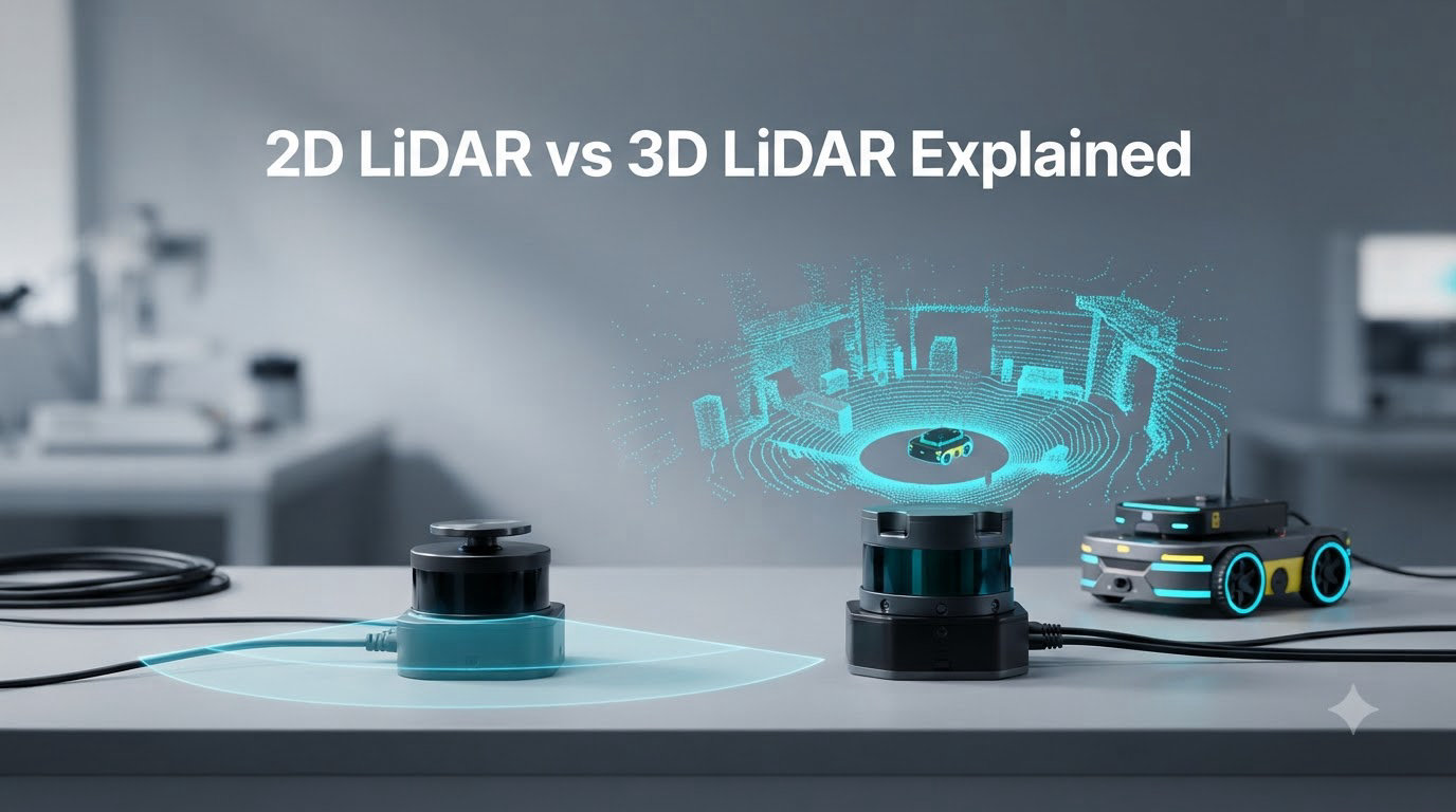
2D LiDAR vs 3D LiDAR is the single most common decision point when you build a robot, drone, or autonomous vehicle, and the wrong pick can blow your budget or leave you blind to obstacles above the floor. In this guide, I will walk you through exactly how each sensor works, where each one wins, and the spec sheet I use when I am picking between them on a real project.
I have spent the last few years testing both sensor types in ROS-based SLAM rigs, low-cost mapping drones, and warehouse AMRs. What follows is the same checklist I apply, refined so you can use it in under an hour.
Table of Contents
What is LiDAR and Why It Matters
LiDAR (Light Detection and Ranging) is a remote sensing technology that fires laser pulses at a target, measures how long the light takes to return, and converts that time-of-flight into distance. Multiply those measurements by millions, and you get a point cloud, a dense 3D map of the world built from individual data points.
It matters because cameras give you color and texture but no reliable depth, radar works at long range but with low resolution, and ultrasonic sensors are cheap but short-sighted. LiDAR sits in the middle, giving you centimeter-level accuracy at distances from a few centimeters up to 250 meters depending on the model.
The most common wavelength used in commercial LiDAR is 905 nanometers, which is invisible and eye-safe at the power levels most consumer and industrial sensors use. Some long-range units use 1550 nm, which is also eye-safe but more expensive.
There are four broad categories of LiDAR you will run into: 1D (single-point distance), 2D (single horizontal plane), 3D (multiple planes, full point cloud), and 4D (3D plus velocity). The “D” stands for dimension, not a fourth axis in space.
How 2D LiDAR Works – Technical Overview
2D LiDAR scans a single horizontal plane, typically 360 degrees, and outputs a 2D slice of distance measurements. Internally, the unit spins a laser emitter and photodetector around a vertical axis, firing thousands of laser pulses per second and recording the return time for each one.
The result is a list of (angle, distance) pairs. If you place a 2D LiDAR on a tabletop and let it run, you will see a flat ring of points, like a top-down slice of whatever surrounds the sensor. Mount that same unit on a robot at floor height, and the slice cuts through chair legs, walls, and people at shin level, which is exactly what indoor AMRs need.
Most 2D LiDARs use either a time-of-flight or amplitude-modulated continuous-wave method. Time-of-flight is the classic approach: emit a short pulse, wait for the return, multiply by the speed of light, divide by two. Continuous-wave compares phase shifts and tends to give better short-range accuracy at lower cost.
Popular examples include the RPLidar A1 and A2, the SICK TiM series, the Hokuyo URG and UST lines, and the budget-friendly LDLIDAR STL27L. Prices for a 2D unit range from around $30 for an RPLidar A1 to several thousand dollars for an industrial SICK unit with safety certification.
How 3D LiDAR Works – Technical Overview
3D LiDAR captures multiple horizontal planes simultaneously, building a true 3D point cloud with vertical resolution. Instead of a single laser, a 3D unit stacks many lasers, often 16, 32, 64, or 128 channels, each firing at a slightly different vertical angle while the whole assembly rotates.
The output is a 3D point cloud with millions of points per second. Where a 2D unit might output 5,000 to 20,000 points per second in a single ring, a 64-channel 3D LiDAR can output over 2 million points per second across a 26-degree vertical field of view.
There are three main architectures for 3D LiDAR:
Mechanical spinning: The classic design, used by Velodyne HDL-64E and the Hesai Pandar series. A motor spins the entire laser stack. These give the best 360-degree coverage but have moving parts that wear out.
Solid-state: No moving parts. Uses MEMS mirrors, optical phased arrays, or flash illumination. Smaller, more rugged, but usually with a narrower field of view. Examples include the Innoviz One and the Luminar Iris.
Hybrid: A semi-moving design, like the Robosense RS-LiDAR-M1, where a small rotating element sits inside a static housing. A compromise between mechanical coverage and solid-state durability.
3D LiDARs are what most people picture when they imagine a self-driving car: the spinning “coffee can” on the roof that you see in any Waymo or Cruise video.
2D vs 3D LiDAR – Key Differences
The core difference between 2D and 3D LiDAR is the number of channels and the resulting point cloud. 2D LiDAR uses a single channel to capture one horizontal plane. 3D LiDAR stacks multiple channels, typically 16 to 128, to capture full volumetric data with vertical resolution.
Here is the side-by-side spec comparison I use on every project. All numbers are typical ranges from common 2026-vintage sensors and can shift by vendor.
| Specification | 2D LiDAR | 3D LiDAR |
|---|---|---|
| Channels | 1 | 16, 32, 64, 128, or more |
| Output | 2D point cloud (single plane) | 3D point cloud (multi-plane) |
| Horizontal FOV | 360 degrees | 360 degrees (mechanical) or 90 to 120 degrees (solid-state) |
| Vertical FOV | 0 degrees (single plane) | 26 to 40 degrees typical |
| Points per second | 5k to 20k | 600k to 2.4M+ |
| Range | 10 to 40 m typical, up to 80 m | 100 to 250 m typical |
| Range accuracy | plus or minus 2 to 5 cm | plus or minus 2 to 3 cm |
| Angular resolution | 0.25 to 1 degree | 0.1 to 0.4 degree horizontal, 0.4 to 3 degree vertical |
| Weight | 50 to 500 g | 0.8 to 4 kg |
| Power draw | 0.5 to 5 W | 8 to 25 W |
| Typical price tier | $30 to $5,000 | $1,000 to $75,000+ |
| Data size per second | ~50 KB | ~30 to 100 MB |
| SLAM algorithm support | Hector, Gmapping, Karto | LOAM, LeGO-LOAM, LIO-SAM |
Notice the data size jump. A single 2D scan is a few kilobytes. A 3D scan can be hundreds of megabytes per second. That has real consequences for storage, network bandwidth, and whether your embedded board can process it in real time.
Point Cloud and Resolution Explained
A point cloud is the raw output of a LiDAR, a set of (x, y, z) coordinates in space, sometimes with intensity (return strength) and timestamp added. Resolution is how densely those points are packed, and it determines how fine an object you can detect.
Angular resolution is the angle between two adjacent laser firings. A 0.1-degree horizontal resolution means 3,600 points per 360-degree sweep, dense enough to pick out a thin pole at 50 meters. A 1-degree resolution gives 360 points per sweep, fine for walls but you will miss the pole.
Vertical resolution matters for 3D only. A 64-channel unit with a 26-degree vertical FOV gives roughly 0.4 degrees of vertical resolution, enough to detect a curb or a low overhang. A 16-channel unit at the same FOV gives about 1.6 degrees, good for open outdoor terrain but weak on small vertical features.
For SLAM, point density determines map quality. Sparse point clouds (low density) are fine for occupancy grid mapping. Dense point clouds are what you need for object detection, semantic segmentation, and 3D reconstruction.
Application Use Cases for Each Type
2D LiDAR is the right call when your robot operates in a flat, indoor environment and the obstacles you care about all sit on a single plane. Think warehouse AMRs, floor-cleaning robots, lawn mowers, and service robots that navigate between rooms.
The classic use case is AGV (Automated Guided Vehicle) navigation in a warehouse. The LiDAR sits at 20 cm above the floor, scans the aisles, and feeds an occupancy grid into the planner. A 2D unit is more than enough because pallets, racks, and human feet all show up in that horizontal slice.
3D LiDAR earns its keep when the world has vertical structure you need to see. Self-driving cars need to spot overhead signs, traffic lights, and the height of a truck bed. Drones need to detect tree branches, power lines, and roof edges. Surveying needs full 3D reconstruction of buildings and terrain.
If you are doing outdoor mapping, 3D LiDAR is almost mandatory. A 2D unit on a drone only captures whatever the slice hits at flight altitude, leaving the ground and the treetops as blind spots. A 3D unit captures the full column from ground to canopy.
Here is a quick application-to-sensor map:
2D LiDAR fits: AGVs, AMRs, floor cleaners, service robots, indoor security sweeps, range-only beacon localization, ROS-based 2D SLAM.
3D LiDAR fits: self-driving cars, autonomous trucks, mapping drones, surveying, forestry, mining, construction site monitoring, military reconnaissance.
Accuracy and Range Comparison
Range accuracy is the difference between a sensor’s reported distance and the true distance. Most modern LiDARs sit between plus or minus 2 cm and plus or minus 5 cm at short range, and degrade slightly at maximum range.
2D LiDARs typically max out at 10 to 40 meters for reliable accuracy. Industrial safety-rated units like the SICK microScan3 and the SICK TiM781 can reach 25 meters or more with safety certification. Short-range 2D units, the kind you would put on a desk-sized robot, might cap at 5 to 12 meters.
3D LiDARs routinely reach 100 to 250 meters. The Velodyne HDL-64E reaches 120 m. The Hesai Pandar XT-32 reaches 300 m. The Luminar Iris pushes 250 m with a 1550 nm laser. Automotive-grade units are designed to detect a dark tire on asphalt at 150+ m, which a 2D unit cannot physically do.
Environmental factors matter. Rain, fog, dust, and snow all scatter the laser and reduce effective range. Highly reflective surfaces (mirror, polished metal) can confuse the detector. Most modern sensors compensate, but plan for 20 to 30 percent range loss in poor weather.
The Elon Musk LiDAR Controversy
Elon Musk has publicly called LiDAR “a crutch” and “fricking stupid” at multiple Tesla events, most notably in 2019 at Tesla Autonomy Day. His position is that a camera-based system, fed to a neural network trained on billions of miles of driving footage, can match or beat LiDAR without the cost and bulk of a spinning sensor on the roof.
Musk’s argument boils down to three points: humans drive using only two eyes (cameras), LiDAR is expensive (Tesla’s stated goal is sub-$1,000 full autonomy hardware), and once you solve vision-based perception, the LiDAR becomes redundant dead weight.
The counterargument, which most of the rest of the autonomous vehicle industry takes, is that cameras fail in low light, glare, and fog in ways LiDAR does not. Waymo, Cruise, Mobileye, and nearly every other serious self-driving program use 3D LiDAR as a primary sensor. Some, like Waymo, use five LiDARs per vehicle.
For robotics applications outside the self-driving niche, the Musk-versus-LiDAR debate is mostly irrelevant. A robot operating in a warehouse, a field, or a forest does not have billions of miles of training data, and LiDAR’s deterministic range measurement is exactly what you want when the perception stack is smaller and the data is sparser.
The practical takeaway: LiDAR is overkill for some tasks, mandatory for others, and the right answer depends on your operating environment and how much training data you actually have.
Integration Complexity and SLAM Compatibility
This is where the rubber meets the road, and where most beginner projects actually fail. 2D LiDAR is dramatically easier to integrate than 3D LiDAR.
For 2D LiDAR, you connect it via USB or serial, install the ROS driver, and within an hour you have a laser scan topic streaming into rviz. The popular ROS SLAM packages (Gmapping, Hector, Karto, Cartographer) all accept 2D scans natively. No IMU required, though adding one improves the result.
For 3D LiDAR, you need a much beefier host computer, typically an NVIDIA Jetson Orin or a desktop with a discrete GPU. Drivers are more complex. The Velodyne driver, the Ouster driver, and the Hesai driver each have their own quirks. You will also want an IMU fused with the LiDAR, and you will run something like LIO-SAM or FAST-LIO to do SLAM.
One popular trick from the ROS community is rotating a 2D LiDAR with a small servo to mimic a 3D sensor. Mount the unit on a yaw mechanism, sweep it up and down once per forward step, and you get a low-resolution 3D point cloud for a fraction of the cost. This is the approach many student drones and mapping robots use.
If your goal is a 3D map on a budget, that 2D-plus-servo approach is worth considering. You trade vertical resolution for cost, and you add mechanical complexity, but you can do the whole thing with an RPLidar and a $10 servo.
For the budget question, the cheapest 3D LiDARs on the market in 2026 are the Livox Mid-70 (around $600) and the Livox Avia (around $1,200). Below that, you are in 2D territory with creative mounting.
4D LiDAR – The Emerging Technology
4D LiDAR is the newest category and is worth understanding even if you are not buying one yet. It adds velocity as a fourth dimension to the point cloud, so every point comes with (x, y, z, v) where v is the radial speed of whatever the point hit.
The most prominent player is Aeva with the Aeries II, used in some trucking and mobility pilots. Other vendors with 4D-capable units include Innoviz (with velocity via doppler), AEye, and the Chinese vendor RoboSense with the RS-LiDAR-M series.
Why does velocity matter? Because stationary objects and moving objects look identical in a normal point cloud. With 4D, your robot instantly knows which points are pedestrians walking toward it, which are cars approaching, and which are background clutter that has not moved in minutes.
For autonomous vehicles, that velocity dimension can replace a separate radar sensor, reducing the sensor stack. For robotics, it is less critical today but likely becomes standard in mid-range sensors over the next several years.
You do not need 4D LiDAR for most current projects, but watch the category. Prices are dropping and integration libraries are improving.
When to Choose 2D vs 3D LiDAR
Use this decision framework when you are about to spend money on a sensor.
Choose 2D LiDAR if: your robot operates indoors on a flat floor, the obstacles you care about are at one height, your processing board is a Raspberry Pi or similar, your budget is under $500, and your SLAM algorithm runs on 2D laser scans.
Choose 3D LiDAR if: you operate outdoors, the environment has vertical structure (trees, buildings, overhangs), the vehicle moves faster than 5 m/s, you need object detection (not just obstacle detection), or you need to detect small features at long range.
Choose 4D LiDAR if: you specifically need per-point velocity and you are building a system where a single missed moving object is a safety event, such as an autonomous truck or a high-speed AMR.
One practical pattern I have used: start with a 2D LiDAR for early development, prove your SLAM and navigation stack, then upgrade to 3D once the rest of the system is solid. Spending $1,500 on a Velodyne before your planner is even working is a common beginner mistake.
Another pattern: use multiple cheap 2D LiDARs at different heights instead of one expensive 3D unit. Two RPLidars stacked at 10 cm and 80 cm give you a coarse 3D view for under $200. The vertical resolution is poor, but the cost savings are real.
For your first project, an RPLidar A2 (around $100) plus ROS Humble plus Gmapping will teach you 90 percent of what you need to know about LiDAR-driven SLAM. Graduate to 3D once you understand the failure modes.
Frequently Asked Questions
Why does Elon Musk not use LiDAR?
Elon Musk argues LiDAR is too expensive and unnecessary because humans drive using only two eyes, and a camera-based neural network can learn to perceive depth from visual data. Tesla’s stated goal is to deliver full autonomy at sub-$1,000 hardware cost, which Musk believes a LiDAR stack cannot match. Most other autonomous vehicle programs disagree and use 3D LiDAR as a primary sensor.
What are the three types of LiDAR?
The three main types of LiDAR are 1D (single-point distance measurement), 2D (single horizontal plane, 360-degree scan, used in indoor robots), and 3D (multi-channel, full vertical point cloud, used in self-driving cars and drones). A fourth category, 4D LiDAR, adds velocity per point and is emerging in 2026.
What is 2D LiDAR?
2D LiDAR is a sensor that scans a single horizontal plane, typically over 360 degrees, and outputs distance measurements as a 2D ring of points. It is used for indoor robot navigation, warehouse AGVs, and floor-cleaning robots where obstacles all sit on one plane.
Can you explain LiDAR in a simple way?
LiDAR works by firing laser pulses at a target, measuring the time it takes for the light to bounce back, and converting that round-trip time into distance. Repeating this millions of times per second builds a point cloud, a precise 3D map of the surroundings.
What are the key differences between 2D and 3D scanners?
A 2D LiDAR uses one channel and outputs a single horizontal ring of points, with a zero-degree vertical field of view and 5k to 20k points per second. A 3D LiDAR uses 16 to 128 channels, outputs a volumetric point cloud, has a 26 to 40 degree vertical field of view, and produces 600k to 2.4 million points per second. 3D LiDAR costs more, draws more power, and requires more processing power to use.
How accurate is 2D LiDAR vs 3D LiDAR?
Both 2D and 3D LiDAR typically achieve plus or minus 2 to 5 cm range accuracy at short distance, with 3D models offering slightly better precision and much longer maximum range. The bigger difference is resolution: 3D LiDAR captures millions of points per second across multiple planes, while 2D captures thousands of points along a single plane.
Conclusion
The 2D LiDAR vs 3D LiDAR choice is not about which sensor is better. It is about which sensor matches your robot, your environment, and your budget. 2D wins for indoor, flat-floor, low-cost projects. 3D wins for outdoor, high-speed, vertical-structure environments. 4D is worth watching for the next several years.
Start with 2D, prove your stack, then graduate to 3D. That sequence has saved me more money and more late nights than any other piece of advice I can give about the 2D LiDAR vs 3D LiDAR decision in 2026.