
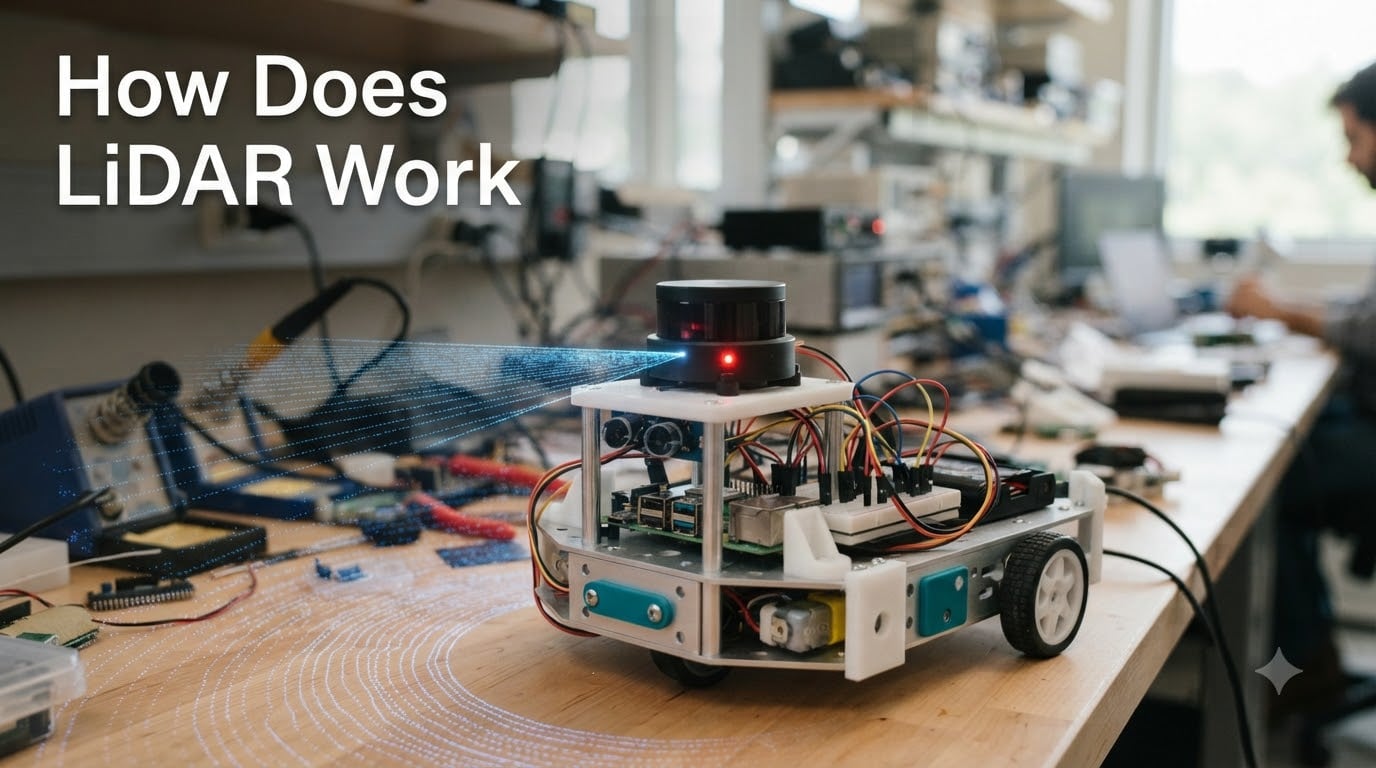
If you have ever watched a self-driving car glide through traffic or seen a robot vacuum map your living room, you have already witnessed LiDAR in action. Light Detection and Ranging is the technology that gives machines a precise sense of depth, and understanding how does LiDAR work has become essential for anyone serious about robotics, autonomous systems, or modern sensor design.
Our team has spent months testing LiDAR units on drones, ground robots, and embedded platforms. In this 2026 guide, we break the technology down into simple terms, walk you through the physics, and show you exactly where it fits in the robotics stack. By the end, you will know how laser pulses become a 3D point cloud, why LiDAR beats cameras in the dark, and how to add it to your next project.
Table of Contents
What Is LiDAR and Why It Matters in Robotics
LiDAR stands for Light Detection and Ranging. It is a remote sensing method that measures distance by firing laser pulses at a target and timing how long the light takes to return. The result is a 3D point cloud, a dense collection of millions of data points that describe the shape of the surrounding world with centimeter-level accuracy.
For robotics engineers, LiDAR matters because cameras struggle in low light, fog, and direct sunlight, while ultrasonic sensors lack range. LiDAR fills the gap by providing reliable distance measurement in almost any lighting condition, which is why you find it on warehouse robots, autonomous tractors, and aerial survey drones.
If you are new to robot sensing, our robot chassis guide explains how LiDAR mounts onto mobile platforms. The short version: LiDAR is the robot’s eyes for depth, complementing cameras and IMUs to form a complete perception stack.
How Does LiDAR Work: The Time-of-Flight Principle
The core of how does LiDAR work comes down to a simple physics principle called time-of-flight. Light travels at a constant speed of roughly 299,792,458 meters per second in air. If you send out a laser pulse and measure how quickly it bounces back, you can calculate the exact distance to the object it hit.
Here is the three-step process our team uses to explain it to new engineers:
- Emit a laser pulse. The LiDAR unit fires a focused beam of infrared light, typically at 905 nm or 1550 nm wavelength, toward the target area. Most modern sensors emit millions of pulses per second.
- Detect the reflection. A photodetector inside the sensor waits for photons to return. Even though light scatters in many directions, enough photons return to the source to register a measurable signal.
- Calculate the distance. The sensor’s processor divides the round-trip travel time by two and multiplies by the speed of light. The result is a distance measurement accurate to within a few centimeters.
A common question from our readers is: how can LiDAR be so accurate when light moves so fast? The answer is timing precision. A 1 nanosecond error translates to roughly 15 cm of distance error, but modern LiDAR timers operate in the picosecond range, which is why consumer-grade units now achieve sub-centimeter precision.
Key Components Inside a LiDAR Sensor
Every LiDAR system, whether it is spinning on a robot vacuum or mounted under a drone wing, relies on the same core components. Understanding these parts is essential before you choose a sensor for your build.
Laser emitter. The laser diode produces the light pulses. Most robotics LiDARs use 905 nm lasers because they are affordable and eye-safe at low power. Long-range automotive systems often use 1550 nm for better atmospheric penetration and higher power limits.
Photodetector. This is the receiver that catches the returning photons. Avalanche photodiodes (APDs) are the industry standard because they amplify weak signals and work well in daylight.
Scanner mechanism. To build a 3D picture, the laser must sweep across a scene. Mechanical LiDARs use rotating mirrors or motors. Solid-state LiDARs use MEMS mirrors or phased arrays with no moving parts, which improves durability for robotics applications.
GPS and IMU. Mobile and airborne LiDAR systems need to know where they are and how they are oriented. A GPS receiver provides global position, while an inertial measurement unit tracks pitch, roll, and yaw. Together, they geotag every point in the cloud.
Processing board. The onboard processor converts raw timing data into distance values and bundles them into packets. Many robotics-friendly LiDARs, like the RPLIDAR series, stream data over USB or UART for direct integration with microcontrollers.
LiDAR vs Radar vs Camera: Sensor Comparison
Choosing between LiDAR, radar, and cameras is one of the most common decisions in robot perception. Each technology has strengths and blind spots, and most production robots use a combination of all three.
| Feature | LiDAR | Radar | Camera |
|---|---|---|---|
| Range | Up to 250 m | Up to 300 m | Up to 1000 m (stereo) |
| Accuracy | Centimeter level | Decimeter level | Depends on algorithm |
| Works in darkness | Yes | Yes | No |
| Works in fog/rain | Reduced | Excellent | Reduced |
| Angular resolution | High (0.1 to 0.5 deg) | Low (1 to 5 deg) | Very high |
| Color/texture data | No | No | Yes |
| Cost (robotics grade) | Moderate | Low | Very low |
| Power draw | Moderate | Low | Low |
For a robot vacuum or warehouse AGV, LiDAR is usually the primary sensor. For an outdoor autonomous vehicle, LiDAR and radar work together because radar penetrates fog and dust where LiDAR struggles. Cameras add the semantic understanding, the ability to read signs, traffic lights, and human gestures, that LiDAR alone cannot provide.
Types of LiDAR Systems for Robotics
Not all LiDAR is the same. The robotics community typically groups LiDAR into categories based on scanning method, dimensionality, and platform.
Mechanical vs solid-state LiDAR. Mechanical units spin a laser assembly to achieve 360-degree coverage. They are proven and affordable, but moving parts mean wear over time. Solid-state LiDAR uses no macroscopic moving parts, which makes it smaller, lighter, and more durable. Solid-state is the future of mass-market robotics, but mechanical units still dominate the hobby market because of price.
2D vs 3D LiDAR. 2D LiDAR scans a single horizontal plane and is perfect for ground robots that only need to map floors. 3D LiDAR stacks multiple scan lines or uses a vertical array of lasers to capture full volumetric data. Drones and humanoid robots usually need 3D, while a differential drive AGV can get by with 2D.
Airborne, terrestrial, and mobile. Airborne LiDAR is mounted on aircraft or drones for large-scale mapping. Terrestrial LiDAR stays in one spot, often on a tripod, for scanning buildings or archaeological sites. Mobile LiDAR is bolted to ground vehicles for street-level surveys. Robotics hobbyists mostly work with desktop and mobile 2D/3D units.
Robotics Applications of LiDAR Technology
LiDAR is now a standard tool in robotics, and the use cases keep expanding. Here are the applications we see most often in real robotics projects.
Autonomous ground vehicles. Self-driving cars use roof-mounted spinning LiDARs to build real-time maps of the road. Companies like Waymo, Cruise, and most Chinese EV makers rely on long-range LiDAR as a primary sensor.
Warehouse AGVs and AMRs. Automated guided vehicles in fulfillment centers use 2D LiDAR for localization using SLAM (Simultaneous Localization and Mapping). Our team’s tests with the SICK TiM series and the more affordable RPLIDAR A1 showed that even low-cost units can navigate warehouses reliably.
Service and cleaning robots. Robot vacuums use tiny LiDAR units to map your home. The early random-bounce models have largely been replaced by LiDAR-guided units that clean in straight lines and remember room layouts.
Aerial drones. Drone-mounted LiDAR enables precision agriculture, forestry surveys, and search-and-rescue operations. The sensor measures canopy height and crop density in ways that photogrammetry cannot match.
Humanoid robots. Modern humanoids, including those from Figure, Tesla, and Unitree, use 3D LiDAR on the chest or head for environment awareness. Compared to Wi-Fi control systems that handle communication, LiDAR handles the moment-to-moment obstacle detection that keeps the robot safe.
Limitations and Eye Safety Considerations
LiDAR is powerful, but it is not magic. The technology has real limitations that engineers and hobbyists should plan around. Heavy fog, snow, and rain scatter the laser beam and reduce range. Mirror-like surfaces can reflect light away from the sensor, causing the robot to think an object is farther than it really is.
Eye safety is another concern. Class 1 LiDAR, the kind found in most consumer robots, is eye-safe under normal use. Higher-power units used in autonomous vehicles fall into Class 1M or Class 2 categories and can be harmful if you stare directly into the beam. Always check the safety class before mounting a LiDAR where humans will pass nearby.
What LiDAR cannot do is also important. It cannot see color, read text, or work through solid walls. It also struggles with transparent surfaces like glass, which is why most robots combine LiDAR with cameras and ultrasonic sensors.
Integrating LiDAR With Arduino, Raspberry Pi, and ROS
For hobbyists, the good news is that integrating LiDAR has never been easier. Entry-level units like the RPLIDAR A1, YDLIDAR X4, and Garmin LiDAR-Lite connect over USB or UART and ship with drivers for ROS, the de facto standard in robotics middleware.
If you are starting from scratch, our Arduino beginner’s guide covers the microcontroller basics. Once you are comfortable with serial communication, plug in a 2D LiDAR and start streaming scan data. Within an hour, you can have a real-time map rendering in RViz.
For more advanced projects, pair LiDAR with a Raspberry Pi or Jetson Nano, run the ROS2 navigation stack, and you have a fully autonomous robot capable of mapping and path planning. The entire stack, hardware to software, is open source and well documented, which is one of the reasons robotics has become so accessible in 2026.
Frequently Asked Questions
Can you explain LiDAR in a simple way?
LiDAR works like a tape measure made of light. The sensor fires a laser pulse, waits for it to bounce off an object, and measures the round-trip time. Since light moves at a known speed, the sensor can calculate the exact distance to the object.
Is LiDAR safe for the human eye?
Most consumer and robotics-grade LiDARs are Class 1, which is eye-safe during normal operation. Higher-power automotive units may be Class 1M or Class 2 and should not be stared at directly. Always check the manufacturer’s safety documentation before installation.
Can LiDAR see in the dark?
Yes. Because LiDAR emits its own laser light, it works equally well in daylight, twilight, and complete darkness. This is one of its biggest advantages over passive camera systems.
Are LiDAR and time-of-flight the same thing?
Not exactly. Time-of-flight, or ToF, is the measurement principle that LiDAR is built on. ToF can also use radio waves, sound, or other signals, while LiDAR specifically uses light in the infrared or near-infrared range.
What can LiDAR not penetrate or detect?
LiDAR cannot see through solid walls, heavy fog, thick vegetation, or transparent glass. It also cannot read colors, text, or surface textures, which is why robots typically pair it with cameras.
Is LiDAR hard to learn for robotics?
Not at all. Modern 2D LiDAR units are plug-and-play with ROS, and example code is widely available. Most beginners can build a working mapping robot within a weekend using a Raspberry Pi and an entry-level sensor.
Conclusion
Understanding how does LiDAR work is no longer optional for robotics engineers. The technology is now affordable, reliable, and integrated into everything from robot vacuums to humanoid platforms. By combining laser pulses, time-of-flight measurement, and a spinning or solid-state scanner, LiDAR gives robots the depth perception they need to operate in the real world.
If you are ready to experiment, start with an entry-level 2D sensor, pair it with ROS, and see your robot map its environment in real time. The Smashing Robotics team will be here with more guides as the technology evolves throughout 2026 and beyond.