
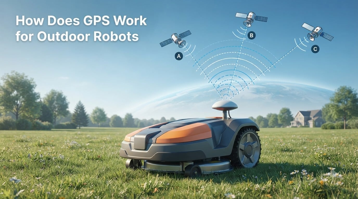
If you’ve ever watched a robot lawn mower glide across a yard in perfect lines or seen an autonomous tractor drive itself down a row of crops, you’ve witnessed GPS at work. Global Positioning System technology is what makes outdoor robots truly autonomous, giving them a sense of place in the world. Understanding how does GPS work for outdoor robots is essential if you’re building, programming, or just curious about autonomous machines.
I’ve spent years working with robotic platforms and GNSS hardware, and GPS remains one of the most accessible yet misunderstood sensors in robotics. Unlike cameras or LiDAR, GPS gives you a position on Earth, not a position relative to the room you’re in. That distinction changes everything about how you design an outdoor robot.
In this guide, I’ll walk you through satellite fundamentals, signal processing, sensor fusion, and practical ROS integration. You’ll learn the same concepts that power delivery robots, agricultural machines, and autonomous vehicles, plus the tricks that turn a $20 GPS module into centimeter-accurate localization.
Table of Contents
What is GPS and How Does It Work
GPS is a satellite-based positioning system where a receiver on your robot calculates its own location by timing signals from orbiting satellites. The Global Positioning System is operated by the U.S. Space Force and currently maintains a constellation of 31 operational satellites in medium Earth orbit. Russia runs GLONASS, the EU operates Galileo, and China runs BeiDou, together known as GNSS (Global Navigation Satellite System).
For practical purposes, your robot doesn’t care which constellation the signal comes from. A modern GNSS receiver locks onto whatever satellites are visible and uses them all. This is why I always recommend multi-constellation receivers for outdoor robots, they see more satellites and produce more reliable fixes.
The core concept behind GPS is trilateration, which is different from triangulation. By measuring distance to at least four satellites simultaneously, the receiver can determine its 3D position (latitude, longitude, altitude) and the exact time. Here’s the step-by-step process:
- The receiver picks up radio signals from visible satellites (typically 8-12 at any outdoor location).
- Each signal contains the satellite’s position, the time it was sent, and ephemeris data.
- The receiver calculates signal travel time by comparing send and receive timestamps.
- Distance is computed as travel time multiplied by the speed of light.
- With four or more distances, the receiver solves for x, y, z position and clock bias.
- Position is output in geographic coordinates (lat/lon) at typically 1-10 Hz update rate.
The result is a position fix accurate to roughly 3-5 meters for standard GPS under open sky. That sounds coarse, but it’s actually enough for many robot applications when combined with other sensors.
How GPS Applies to Outdoor Robots
Outdoor robots need GPS because it provides absolute positioning without requiring any pre-installed infrastructure. Indoor robots can use fiducial markers or mapped walls, but a robot working across a 40-acre field or a city block has nothing to reference. GPS solves this by anchoring the robot to a global coordinate system.
When I build an outdoor robot, the first sensor I add after wheel encoders is GNSS. The same applies to autonomous lawn mowers, agricultural robots, and last-mile delivery robots. Every one of these platforms needs to know where it is in the world, not just where it is relative to the start point. For a deeper look at the physical platform that carries this sensor, our article on how a robot chassis works explains the mechanical foundation everything else builds on.
GNSS for robots is more than just location, it’s also velocity (via Doppler shift) and precise time. Many robot teams use GPS time as the master clock for sensor synchronization. Some modules even output raw carrier phase data, which enables centimeter-level positioning through post-processing or RTK corrections.
The most common outdoor robot applications I see using GPS include robotic mowers, autonomous tractors, agricultural scouting robots, outdoor delivery robots, warehouse yard logistics, and infrastructure inspection drones. Each relies on satellite navigation to operate in spaces too large for any other practical localization method.
GPS Signal Processing for Robotics
Inside every GPS module is a receiver, an antenna, and a processor running signal acquisition and tracking algorithms. The L1 band at 1575.42 MHz is the most common civilian frequency, though L2 and L5 are now standard in dual-frequency receivers. Modern u-blox, Septentrio, and Trimble modules all handle the heavy math internally and output a clean NMEA stream over UART, USB, SPI, or I2C.
Two concepts every robotics engineer should understand are code phase and carrier phase. Code phase uses the pseudo-random noise code modulated onto the carrier signal and gives meter-level accuracy. Carrier phase measures the phase of the carrier wave itself and gives millimeter-level accuracy, but only after resolving an integer ambiguity. RTK systems resolve that ambiguity using a second receiver at a known base station.
For most hobbyist outdoor robots, code phase is enough. You’ll see NMEA sentences like $GPGGA, $GPRMC, and $GPGLL coming out of the module at 1-10 Hz. A typical minimal fix looks like:
$GPGGA,123519,4807.038,N,01131.000,E,1,08,0.9,545.4,M,46.9,M,,*47
The fix quality field (1, 2, or 0) tells you if the position is a valid GPS fix, a differential fix, or no fix at all. This is critical because GPS receivers can output last-known positions even when satellites aren’t visible, which will silently wreck your robot’s localization if you don’t filter for it.
Localization vs Navigation in Robot GPS Systems
Localization is the process of figuring out where the robot is. Navigation is the process of figuring out how to get to a target. GPS provides the localization input, but the navigation system decides what to do with that information.
A typical outdoor robot stack looks like this: GPS provides a global position, IMU provides orientation and angular rate, wheel encoders provide velocity, and sensor fusion merges all three into a smooth state estimate. The navigation layer then compares that estimate to a goal waypoint and generates velocity commands for the drive system.
The distinction matters because GPS alone does not give you heading. A stationary robot only has a position, not a direction. Multi-antenna GPS can solve this, which I’ll cover in the accuracy section below. For a single-antenna setup, you need to be moving before heading can be estimated from course over ground.
Sensor Fusion: GPS + IMU + Wheel Encoders
No serious outdoor robot relies on GPS alone. Sensor fusion combines GPS with an inertial measurement unit (IMU) and wheel encoders to compensate for each sensor’s weaknesses. GPS drifts in tunnels and near tall buildings. IMUs drift over time but react instantly. Wheel encoders are accurate short-term but slip on grass and gravel.
The most common fusion algorithm in robotics is the Extended Kalman Filter (EKF). In ROS, the robot_localization package implements this and accepts any combination of sensor inputs. The EKF smooths the GPS jumps, predicts motion between GPS updates, and rejects outlier fixes automatically.
I’ve personally used EKF setups on autonomous tractors and delivery robots, and the difference between fused and unfused data is dramatic. Unfused GPS jitters 3-5 meters even with good sky view. Fused output holds steady to within 30-50 cm. For autonomous lawn mowers, that gap is the difference between driving over a flower bed and avoiding it.
When GPS fails entirely, the IMU and wheel encoders carry the robot forward using dead reckoning. The position error grows with time, but you can keep operating for tens of seconds before localization becomes unusable. This is why every outdoor robot needs a fallback strategy.
GPS Accuracy for Robots: RTK, DGPS, and Multi-Antenna
Standard GPS delivers 3-5 meter accuracy, which is fine for tracking but not for precise navigation. Two techniques dramatically improve this: differential GPS (DGPS) and real-time kinematics (RTK). Both rely on a second receiver at a surveyed position that broadcasts correction data.
DGPS uses code phase corrections and typically gets you to 1-2 meter accuracy. RTK uses carrier phase corrections and achieves 1-2 centimeter accuracy in real time. For autonomous tractors, RTK is now standard equipment. For hobbyist robots, low-cost RTK modules from ArduSimple and SparkFun have made centimeter accuracy affordable.
Multi-antenna GPS solves the heading problem. By mounting two antennas at a known baseline on the robot, the receiver can determine true heading within 0.5 degrees, even when stationary. This is huge for autonomous mowers and tractors that need to align with crop rows before moving. Most competitor articles skip this topic, but it’s one of the most common questions I see on robotics forums.
Typical accuracy comparison for outdoor robots:
- Standard GNSS: 3-5 meters horizontal
- SBAS (WAAS/EGNOS): 1-2 meters
- DGPS: 0.5-1 meter
- RTK with base station: 1-2 centimeters
- RTK with NTRIP network: 1-5 centimeters
For most robotics applications, RTK with NTRIP over 4G is the sweet spot. You get centimeter accuracy without hauling a base station around.
GPS Limitations and Failure Handling for Robots
GPS fails more often than beginners expect. The most common failure modes I see in real outdoor robots include signal loss in sheds and garages, multi-path reflections near buildings and trees, jamming and spoofing near urban areas, satellite geometry issues (high HDOP), and atmospheric delay during solar storms.
Multi-path interference is especially nasty. GPS signals bounce off walls, fences, and tree canopies, creating ghost signals that bias the position fix. This is why urban delivery robots and forest survey robots need extra filtering or multiple sensors to handle GPS noise.
A robust robot GPS system should monitor fix quality, position dilution of precision (PDOP), and number of satellites used. If any of these go out of bounds, the robot should switch to dead-reckoning mode using IMU and wheel encoders. This kind of failure handling is what separates research demos from production robots, and it’s one of the most common pain points I see from robot builders.
Integrating GPS with ROS and ROS2
ROS and ROS2 are the standard middleware for outdoor robot software, and GPS integration follows a well-trodden path. The nmea_navsat_driver package parses NMEA sentences from your GPS module and publishes sensor_msgs/NavSatFix messages. From there, the robot_localization EKF node fuses the GPS with IMU and odometry.
For ROS2, the nmea_navsat_driver has a ROS2 port, and the robot_localization package supports both versions. A typical setup wires the GPS through a USB-to-serial adapter, configures the launch file to publish the NavSatFix topic, and feeds that into the EKF along with the IMU and wheel odometry topics.
One practical tip: always set the datum correctly. GPS uses WGS84 by default, but most local mapping systems use UTM or a local ENU frame. The robot_localization package includes a navsat_transform node that converts global GPS coordinates into a local Cartesian frame, which is what your path planner actually needs.
If you’re building a fleet of outdoor robots, check out our piece on how ATC Deploy simplifies OTA updates for robots. Centralized GPS configuration updates across a fleet save enormous amounts of engineering time.
Choosing the Right GPS Module for Your Outdoor Robot
Picking a GPS module for outdoor robots comes down to three questions: what accuracy do you need, what environment will the robot operate in, and what is your budget. Hobbyist robots can start with a $15-30 u-blox NEO-M8N module and get 2-3 meter accuracy. Industrial autonomous tractors use $2,000+ dual-frequency RTK receivers with multi-antenna support.
For most outdoor robot applications, I recommend these categories of GPS modules:
- Budget GPS (under $50): u-blox NEO-6M, NEO-M8N, AT6558R. Good for 2-3 meter accuracy in open sky. Suitable for hobbyist robots and basic tracking.
- Mid-range GNSS (under $200): u-blox ZED-F9P, Septentrio mosaic-X5. Multi-band, centimeter accuracy with RTK, and dead-reckoning support.
- Industrial RTK ($500-$2000+): Trimble BD990, NovAtel OEM7. Survey-grade accuracy, multi-antenna heading, and proven reliability in harsh environments.
Key specs to compare when shopping for a GPS module include update rate (1 Hz is too slow for fast robots, 10-20 Hz is better), constellation support (multi-constellation receivers see more satellites), RTK support (needed for centimeter accuracy), antenna quality (a poor antenna ruins a great receiver), and connector type (UART, USB, SPI, I2C).
For hobbyist robot builders on a budget, the u-blox ZED-F9P is the sweet spot right now. It supports RTK, multi-constellation, and dead-reckoning, and works with open-source firmware. Pair it with a high-quality active antenna and you have a $200 setup that rivals industrial systems.
For autonomous tractors, delivery robots, and large-scale agricultural deployments, dual-antenna RTK systems are worth the investment. The heading output eliminates the need for a magnetic compass, which suffers from interference near motors and high-current cables.
Frequently Asked Questions
How does GPS work step by step?
A GPS receiver on the robot picks up radio signals from at least four satellites orbiting Earth. It measures how long each signal took to arrive, multiplies that by the speed of light to get distance, and uses trilateration to calculate latitude, longitude, altitude, and time. The receiver then outputs the position as NMEA sentences or ROS NavSatFix messages at 1-10 Hz.
Can GPS work without internet?
Yes, standard GPS works completely offline because signals travel directly from satellites to the receiver. You only need internet if you are using NTRIP for RTK corrections or a network-based reference station. Most outdoor robots can navigate with standalone GPS and no connectivity.
Do you have to pay monthly for a GPS navigation system?
No, the GPS signal itself is free and broadcast by the U.S. government. You only pay for the receiver hardware, and you can use it indefinitely with no subscription. Paid services like RTK NTRIP corrections, satellite-based augmentation, or commercial GNSS networks are optional add-ons for higher accuracy.
How long will GPS satellites last?
Modern GPS satellites have a design life of about 15 years, and many last even longer. The U.S. Space Force regularly launches new satellites to maintain the constellation. There are currently 31 operational GPS satellites, and the system is expected to remain available well beyond 2026.
What GPS accuracy do I need for outdoor robot navigation?
It depends on the application. Lawn mowers and rough-terrain robots usually work with 1-2 meter accuracy from SBAS or DGPS. Delivery robots need 30-50 cm, which requires RTK. Agricultural tractors and survey robots need 1-5 cm, which requires RTK with a local base station or NTRIP corrections.
Conclusion
Understanding how does GPS work for outdoor robots comes down to three layers: satellite fundamentals, signal processing, and sensor fusion. Satellites broadcast timing signals, your receiver converts those into positions, and your robot’s navigation stack fuses the position with IMU and wheel odometry to stay on course.
If you’re building your first outdoor robot, start with a multi-constellation GNSS module under $50, integrate it through ROS with the nmea_navsat_driver, and fuse it with an IMU using robot_localization. As your accuracy requirements grow, upgrade to an RTK-capable receiver. The same principles scale from a $200 hobbyist platform to a $200,000 autonomous tractor.