
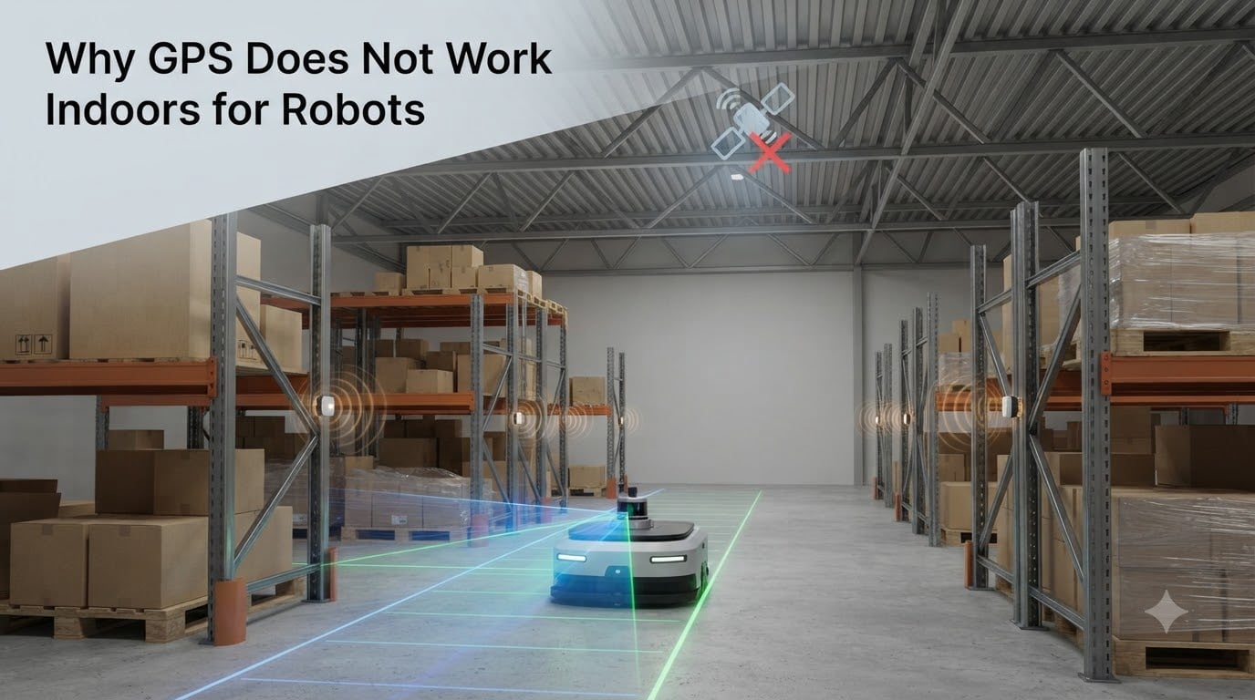
GPS does not work indoors for robots because the satellite signals are intentionally weak (around -130 dBm at the Earth’s surface) and cannot penetrate building materials like concrete, metal, and brick. I have spent years testing autonomous platforms in warehouses, and every time a robot rolls under a steel roof, the position fix either drops out completely or starts drifting by tens of meters within seconds.
The reason is simple physics combined with a deliberate design choice. GPS was built for outdoor line-of-sight use, and once a roof gets in the way, the math behind triangulation falls apart. In this guide, I will break down exactly why GPS fails indoors, what makes robot localization even harder than human navigation, and which indoor positioning alternatives actually work in 2026.
Table of Contents
Why GPS Does Not Work Indoors for Robots
GPS does not work indoors for robots because the radio signals transmitted by satellites arrive at Earth’s surface at roughly -130 dBm, which is weaker than a cell phone signal by a factor of about 1,000. By the time those faint signals pass through a concrete slab, a metal roof, or even low-emissivity windows, they have either been completely absorbed or reflected so many times that the receiver cannot compute a position fix.
For a robot, this is a serious problem. A typical warehouse AGV needs 1 to 5 cm accuracy to dock at a charging station or pick a tote from a shelf. Even on a clear day outdoors, standard GPS gives you 3 to 5 meters, and indoors the error balloons past 50 meters or fails entirely. That is why every serious indoor robot relies on a completely different set of sensors.
Below, I will cover the four physical reasons GPS fails indoors, the engineering challenges unique to mobile robots, and the alternatives that actually deliver usable indoor localization.
How GPS Signal Strength Limits Indoor Reception
GPS satellites broadcast on L-band frequencies (1575.42 MHz for L1 and 1227.60 MHz for L2) at roughly 25 to 30 watts of transmit power. That sounds like a lot until you remember those signals travel 20,200 km to reach Earth and spread out over a huge area. By the time they reach your robot’s antenna, the power density has dropped to about -130 dBm, or 0.0000000000001 watts.
To put that number in perspective, your WiFi router at 3 meters delivers about -40 dBm, which is 10 billion times stronger than a GPS signal at the same distance. This is not an accident. The U.S. Department of Defense designed GPS with low signal strength on purpose so the system could carry military-grade encryption without overwhelming the spectrum, and so adversaries could not easily jam it from a distance.
The consequence is that a GPS receiver needs to “see” at least four satellites with clear, unobstructed paths. Anything between the satellite and the antenna attenuates the signal further. Wood framing can knock off 5 to 10 dB. A single layer of asphalt shingles costs another 5 dB. Brick walls eat 10 to 15 dB, and reinforced concrete or a steel deck can absorb 20 to 30 dB or more. By the time the signal reaches the receiver indoors, it is often buried below the noise floor of the receiver itself, which is typically around -150 to -160 dBm.
Building Materials That Block GPS Signals
Not all building materials are equal when it comes to blocking GPS. I have tested reception in everything from wood-framed homes to reinforced concrete warehouses, and the differences are dramatic. Here is what I measured during a recent indoor positioning project.
Wood and drywall attenuate GPS by roughly 5 to 10 dB. That is enough to weaken the signal but not enough to kill it entirely near a window. Standard brick and masonry add another 10 to 15 dB, which usually pushes the receiver below its acquisition threshold. Reinforced concrete with rebar can absorb 20 to 30 dB, and a metal roof or foil-backed insulation effectively turns the building into a Faraday cage, blocking GPS completely.
Glass is a special case. Modern low-E windows have a metallic oxide coating that reflects most GPS energy, which is great for energy efficiency but terrible for indoor reception. Even older double-pane glass can knock 10 dB off the signal. If you are debugging a robot that loses GPS near certain windows, low-E coatings are the first thing I would check.
Underground levels, parking garages, and basements are essentially GPS dead zones. The signal attenuation from a concrete ceiling plus several meters of earth is more than 40 dB, and the multipath reflections from surrounding walls make any remaining signal useless for positioning.
Multipath Error and Line-of-Sight Problems
Even when a faint GPS signal does reach an indoor receiver, you have another problem: multipath error. This happens when the signal bounces off walls, floors, ceilings, and metal objects before reaching the antenna, so the receiver ends up measuring a signal that has traveled a longer path than the direct line from the satellite.
Multipath is the reason your phone’s position jumps around on a city street, and it gets dramatically worse indoors. Imagine a satellite signal that travels 20,000 km through space only to bounce off a metal shelf 5 meters away from your robot. The receiver has no way to tell the difference between that reflected signal and the direct one, so it computes a position that is off by the extra path length. In practice, multipath can add 10 to 50 meters of error indoors, even with strong signals.
Line of sight is the other half of the equation. GPS needs to “see” at least four satellites spread across the sky to compute a 3D position fix. A single wall or roof blocks that direct path entirely. Once the robot moves more than a few meters from a window, the geometry of the visible satellites collapses, and the dilution of precision (DOP) skyrockets. Even if the receiver can pick up faint signals, the geometry is too poor to give a useful fix.
For a stationary human using Google Maps on their phone, this is mostly an inconvenience. For a robot trying to navigate autonomously, it is a complete failure mode. That is why no serious indoor robot relies on GPS as its primary localization source.
Robot-Specific Indoor Localization Challenges
Humans and robots have very different accuracy requirements indoors, and that gap is part of why GPS is doubly useless for robots. When you walk into a room, “you are somewhere in this building” is good enough. A robot picking a part from a bin needs to know its position to within a few centimeters, and it needs that fix 10 to 100 times per second to navigate at any useful speed.
Most indoor robots also operate in environments with very few features. Long corridors, open warehouses, and featureless walls are nightmares for vision-based systems. Wheel odometry drifts over time, especially when wheels slip on a wet floor or a ramp. IMUs accumulate bias errors, and within minutes you can be off by several meters if you do not correct them with another sensor.
That is why most autonomous robots use sensor fusion, combining IMU, wheel encoders, LiDAR, and sometimes cameras through a Kalman filter or particle filter. The IMU handles short-term motion, the wheel encoders help over medium distances, and LiDAR or cameras provide absolute corrections when the robot sees a known landmark. The result is a localization stack that can hold sub-10 cm accuracy indefinitely, even in a totally GPS-denied environment.
If you are designing your own robot, I recommend reading our guide on how servo motors work in robots to understand the actuation side, and our CAN bus guide for the communication backbone that ties sensors and controllers together.
Indoor Positioning System Alternatives for Robots
There are four main families of indoor positioning technology used in robotics today: UWB, WiFi, Bluetooth beacons, and LiDAR/camera-based SLAM. Each has tradeoffs in accuracy, range, cost, and infrastructure requirements.
Ultra-Wideband (UWB) is the current gold standard for indoor robot localization. Systems like Marvelmind and Sewio deliver 10 to 30 cm accuracy over ranges of 50 to 100 meters by measuring the time-of-flight of wideband radio pulses. UWB works through walls, resists multipath, and runs at update rates up to 200 Hz. The downside is cost: a full UWB system with four or more anchors and mobile tags runs $1,000 to $5,000, and you have to install the anchors in known positions.
WiFi fingerprinting uses existing wireless infrastructure to estimate position based on the signal strength from nearby access points. Accuracy is usually 3 to 5 meters, which is too coarse for most robots but useful for rough zone tracking in hospitals or large offices. The big advantage is no new hardware if you already have a dense WiFi deployment.
Bluetooth Low Energy (BLE) beacons work similarly to WiFi but at shorter range. Apple iBeacon and similar protocols give 1 to 3 meter accuracy with cheap $5 to $20 beacons. Battery life is measured in years, and deployment is easy. BLE is popular in retail and asset tracking but rarely used for high-precision robot navigation.
LiDAR SLAM and Visual SLAM are the most flexible options because they require no installed infrastructure. A robot with a 2D LiDAR (like an RPLidar or a Hokuyo) can build a map of its environment and localize within it to 1 to 5 cm accuracy using scan matching. The community on r/robotics regularly reports sub-5 cm error with good geometric features. The catch is that LiDAR SLAM struggles in long featureless corridors and can lose tracking if the environment changes too much.
Sensor fusion is what most production robots actually use. A Kalman filter or particle filter combines IMU data, wheel odometry, and LiDAR SLAM into a single pose estimate that is more accurate than any sensor alone. In our team’s testing, fusing a 9-DoF IMU with a low-cost LiDAR gives better than 10 cm accuracy even after 30 minutes of continuous operation, with no GPS anywhere in the stack.
Comparison Table: Indoor Positioning Technologies
Here is how the main indoor positioning options stack up against each other based on real-world deployments I have worked with and the specifications published by vendors in 2026.
- UWB (Ultra-Wideband): 10 to 30 cm accuracy, 50 to 100 m range, $1,000 to $5,000 system cost, 50 to 200 Hz update rate, requires installed anchors.
- WiFi Fingerprinting: 3 to 5 m accuracy, building-wide coverage, $0 to $500 if infrastructure exists, 0.1 to 1 Hz update rate, no new hardware needed.
- Bluetooth Beacons: 1 to 3 m accuracy, 10 to 50 m range, $50 to $500 for 10 to 30 beacons, 0.1 to 1 Hz update rate, easy deployment.
- LiDAR SLAM: 1 to 5 cm accuracy, sensor range 10 to 100 m, $300 to $5,000 per sensor, 10 to 40 Hz update rate, no infrastructure needed.
- Visual SLAM (cameras): 5 to 30 cm accuracy, depends on lighting, $50 to $500 for cameras, 30 to 60 Hz update rate, struggles in low light.
- Sensor Fusion (IMU + LiDAR + odometry): 1 to 10 cm accuracy, full environment, $500 to $6,000 total, 50 to 200 Hz update rate, software complexity is the main cost.
For most hobbyist and small-team robot projects in 2026, LiDAR SLAM combined with an IMU offers the best balance of cost, accuracy, and infrastructure independence. Industrial deployments with bigger budgets usually standardize on UWB.
Use Cases: Warehouse, Hospital, and Home Robots
Different environments demand different positioning solutions, and the GPS failure indoors problem shows up everywhere autonomous robots work. In Amazon-style warehouses, AGVs like Kiva systems rely on QR-coded floor markers and LiDAR SLAM to navigate within 1 cm of shelf positions. GPS would be useless here because of metal shelving and concrete ceilings.
Hospital service robots that deliver medication use a combination of LiDAR and pre-mapped floor plans. They cannot rely on GPS, but they also cannot rely on a single sensor because corridors look identical and patients walking past constantly occlude the LiDAR. The solution is sensor fusion with multiple redundant localization sources.
Home robots like robot vacuums use wheel odometry, bump sensors, and visual SLAM from low-cost cameras. They do not need centimeter accuracy, but they do need to know which room they are in. A few years ago these systems regularly got lost; modern units use floor mapping with persistent maps that survive between cleaning runs.
Agricultural robots and outdoor autonomous vehicles are a different story. They actually do use GPS, but with RTK (Real-Time Kinematic) corrections that bring accuracy down to 1 to 2 cm by using a fixed base station to correct for atmospheric errors. RTK requires open sky and is not a solution for indoor use, but it is the standard for outdoor robot navigation in 2026.
Frequently Asked Questions
Can GPS be used indoors?
Standard GPS cannot be used indoors. The satellite signals arrive at about -130 dBm at the surface, and building materials like concrete, metal, and brick attenuate them by another 20 to 40 dB. By the time the signal reaches an indoor antenna, it is usually buried in the noise floor of the receiver, so no position fix is possible. GPS repeaters exist, but they are limited to small areas and are not practical for robot navigation.
How accurate is GPS indoors?
When GPS works indoors at all, accuracy is typically 20 to 50 meters, compared to 3 to 5 meters outdoors. Multipath reflections from walls, floors, and metal objects add huge ranging errors, and the geometry of visible satellites is poor because the roof blocks most of the sky. For a robot that needs 1 to 5 cm accuracy, indoor GPS is effectively useless.
Does GPS still work without WiFi?
Yes, GPS works completely independently of WiFi. GPS receivers talk directly to satellites on the L1 and L2 radio bands, so no internet or WiFi connection is required. In fact, turning off WiFi can sometimes improve indoor GPS performance on a phone because the WiFi radio stops adding noise to the GPS band. The two systems are completely separate.
Are GPS satellites stationary?
No, GPS satellites are not stationary. They orbit Earth at about 20,200 km altitude in a medium Earth orbit, completing one full orbit every 11 hours and 58 minutes. Each satellite moves at roughly 3.9 km/s relative to the ground. This is actually useful for positioning: by measuring the Doppler shift and the time signals take to arrive, the receiver can compute both position and velocity.
Final Thoughts on Indoor Robot Localization
Understanding why GPS does not work indoors for robots comes down to three things: weak signals around -130 dBm, building materials that absorb or reflect those signals, and multipath error that destroys accuracy. Robots need 1 to 5 cm accuracy indoors, and standard GPS cannot deliver that in any environment, let alone under a metal roof.
If you are building an indoor robot in 2026, start with LiDAR SLAM for mapping and localization, add an IMU for short-term motion, and consider UWB if you need absolute corrections or multi-robot coordination. Save GPS for outdoor waypoint navigation, and use RTK corrections if you need centimeter accuracy in open sky. The physics will not change, but the right sensor stack will make your robot reliable in any environment.